The list of names for the 2024 hurricane season are:
- Alberto
- Beryl
- Chris
- Debby
- Ernesto
- Francine
- Gordon
- Helene
- Isaac
- Joyce
- Kirk
- Leslie
- Milton
- Nadine
- Oscar
- Patty
- Rafael
- Sara
- Tony
- Valerie
- William

Tropical information for the Coast, by the Coast,
The list of names for the 2024 hurricane season are:
The devastating impact of Hurricane Idalia is still being felt across the affected regions. This powerful storm made landfall with tremendous force, leaving behind a path of destruction and despair. The communities in its wake are faced with the daunting task of rebuilding their lives amidst the wreckage.
Idalia unleashed torrential rains, fierce winds, and widespread flooding, causing extensive damage to infrastructure, homes, and businesses. The aftermath of the storm is a stark reminder of the need for preparedness and resilience in the face of nature’s fury.
As recovery efforts continue, it is crucial for communities, government agencies, and relief organizations to come together to provide support to those affected by this catastrophic event. From emergency response teams and volunteers on the ground to the generous donations pouring in, the spirit of solidarity is evident.
Despite the immense challenges ahead, the resolve of the affected communities remains unwavering. They are determined to rise above the wreckage and rebuild a stronger, more resilient future. It is a testament to the indomitable human spirit in the face of adversity.
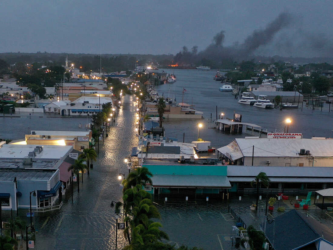
Hurricane Idalia made landfall on Florida’s Gulf Coast on Wednesday, August 30, 2023, as a high-end Category 3 hurricane with maximum sustained winds near 125 mph (205 kph). The storm weakened to a tropical storm with winds of 70 mph (113 kph) by late Wednesday afternoon.
Idalia made landfall near Keaton Beach, Florida, at 7:45 a.m. EDT. The storm brought with it a storm surge of up to 10 feet (3 meters) in some areas, as well as heavy rain and strong winds.
The storm caused widespread damage in Florida, with downed trees and power lines, flooding, and structural damage. At least two people were killed in weather-related accidents.
Idalia also brought heavy rain and flooding to Georgia and South Carolina. As of Thursday morning, more than 400,000 customers in Florida, Georgia, and South Carolina were without power.
The storm is expected to continue to weaken as it moves northeast, but it is still expected to bring heavy rain and strong winds to the Carolinas and Virginia.
Here are some of the hurricane’s stats:
The overall effects of the landfalling hurricane are still being assessed, but it is clear that Idalia was a powerful storm that caused significant damage in Florida and other parts of the Southeast.
There’s a tropical storm brewin’ in the Gulf, y’all!
The National Hurricane Center (NHC) says it’s got a 70% chance of becoming a named storm, and it could make landfall in the northeastern Gulf of Mexico.
We don’t know how strong it’ll be yet, but it could bring heavy rain, gusty winds, and coastal flooding. Coastal Alabama isn’t expected to be directly impacted, but it’s still a good idea to stay informed and prepared.
Here’s what you can do:
We’ll keep you updated as more information becomes available.
In the meantime, let’s hope this tropical storm doesn’t cause too much trouble.
Day 1 (June 20, 2023): Tropical Storm Bret will continue to move west-northwestward over the central Atlantic Ocean.
Day 2 (June 21, 2023): Tropical Storm Bret will pass near or over the Lesser Antilles.
Day 3 (June 22, 2023): Tropical Storm Bret will continue to move west-northwestward and could become a hurricane.
Day 4 (June 23, 2023): Hurricane Bret will continue to move west-northwestward and could make landfall in the northeastern Caribbean Sea.
Day 5 (June 24, 2023): Hurricane Bret will weaken as it moves over land and could dissipate over the Dominican Republic or Haiti.
Day 6 (June 25, 2023): The remnants of Hurricane Bret will continue to move west-northwestward and could bring heavy rain to Cuba and the Bahamas.
Day 7 (June 26, 2023): The remnants of Hurricane Bret will dissipate over the western Atlantic Ocean.
Please note that this forecast is based on the current data and conditions. If the data or conditions change, the forecast may also change. It is important to stay informed about the latest forecasts and to take appropriate action if Bret makes landfall.
Here are some additional things to keep in mind:
This post is an experimental product using Artificial Intelligence. The process and prompts are still in development and are subject to errors. This product may contain errors and is provided solely as a testing platform for potential new methodologies to aid in monitoring and presenting data in a concise, user-friendly manner.
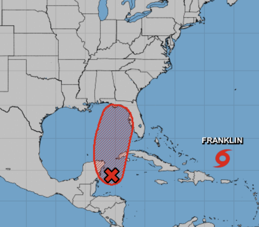
TD2 has formed in the Gulf of Mexico and is expected to become Tropical Storm Arlene. Little to no impact on the Gulf Coast is expected at this time.
We are monitoring this system and will provide updates as needed/
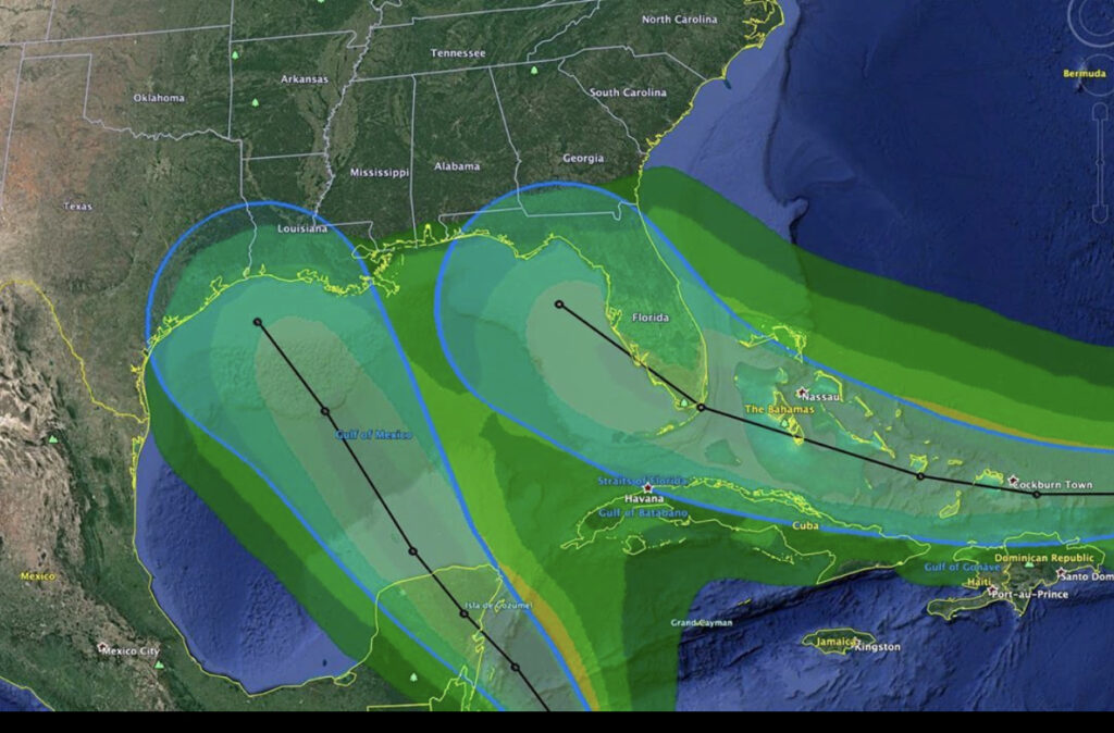
First and foremost, the image represented above is a graphic example of a potential situation that could exist in the Gulf of Mexico over the next several days. It is not a forecast graphic or model, it is just an illustration of one of many possible scenarios. Additionally, Gulfstorm.net does not typically post about Tropical Depressions. In this instance, there is a chance for a rare phenomenon called the Fujiwhara Effect to occur in the GoM. The event is named after the Japanese scientist Sakuhei Fujiwhara who discovered the effect in 1921.
In the phenomenon, when two tropical systems get close to each other, they will begin to interact with one another. At a distance of around 900 miles, they will begin orbiting one another, much as the moon orbits the Earth. In that case, they are competing for the same resources, which limits each low pressure system’s ability to significantly strengthen. If one of the storms is “stronger” than the other, and their centers of circulation are around 200 miles from one another, the “stronger” system will absorb the other system, which would most likely result in a RIC (Rapid Intensification Cycle). Simply put the stronger storm would get even stronger.
We will continue to monitor these systems and provide updates as more data comes in.
In terms of the Northern Gulf of Mexico, our early analysis suggests a partial Gulf of Mexico emergence, and then a hard north turn along the western peninsula of Florida.
Currently, we are looking at a minimal impact to the Gulf of Mexico.
However, these conditions can and will change rapidly, so please remain diligent in monitoring your local, state, and federal advisories.
The list of Hurricane names for 2019 is out, and is as follows:

The upcoming season, which starts on June 1, 2019, is expected to be less active than 2018.
Hurricane Michael has become a major hurricane with maximum sustained winds of 120mph. At the time of this writing, we are an hour away from the next official NHC advisory, however, there are many indications from the current hurricane hunter mission to suggest that Michael could be a Catagory Four hurricane now, or overnight.
In Gulf Shores and nearby areas, the surf is up and the winds are gradually increasing. Michael is expected to move to the northeast of its current location, however, a more westward landfall from the current track is not out of the question. Having said that, at this time our staff does not anticipate hurricane conditions in the Gulf Shores/Orange Beach area, but full anticipate sustained tropical storm conditions. (Winds 35-50mph).

This photo depicts the surf on west beach in Gulf Shores on October 9th, in Gulf Shores.
Previous models have had Alberto to the west of the Gulf Shores/Orange Beach area, which would have meant significant rainfall, coastal flooding, wind concerns, and isolated tornadoes. Two things have happened. First, while the center of circulation has started to “wrap” it has drawn in dry air, which impedes development. Second, Alberto has stayed farther east than initially expected, over lower SST’s (sea surface temperature) and thus, the estimated landfall is between Pensacola and Panama City.
For Gulf Shores, currently, we will be looking at a couple of windy days with patchy strong rain, but currently no real threat other than the very real life-threatening issue of rip currents.