Named Storm Dorian – 2013

Tropical Storm Dorian formed today out of a tropical depression and is currently 550 miles west of the Cape Verde Islands near the African Coast and is moving generally westward at 20 miles per hour. Current tracking is indicating that the storm will be over unfavorably cool waters of the Atlantic until Monday, July 29 and at that time it will be near Puerto Rico. There are signs that this storm may travel just north of Hispaniola around Tuesday, July 30 and may gain strength. We are tracking this storm and if computer modeling starts to indicate a US involvement, we will update this information.

Use this interactive link to check all conditions in your own area:

http://www.nws.noaa.gov/largemap.php

For up to the minute official advisories and information, please visit the NHC website in Miami:

http://www.nhc.noaa.gov/

=============================================

“THIS IS NOT AN OFFICIAL ADVISORY. These updates and advisories are based upon information from our own computer models, NOAA, Local Weather Data Centers, deep water Buoy Data, and other publicly available sources. FOR THE SAFETY OF YOUR PROPERTY AND PERSON, please refer to your Local, State, and Federal Authority updates for Official Advisories and Orders. For up to the minute advisories and official updates, it is essential that you monitor your local Emergency Government, NOAA and Local Media Broadcasts. Please do not make personal safety decisions based upon information presented here in this Unofficial Advisory.”

Tropical Storm Research Center, Gulf Shores, Alabama.

http://www.wootaah.blogspot.com

============================================
Named Storm Chantal – 2013

We are tracking Tropical Storm Chantal.  It is currently in the east central Atlantic nearing the Windward Islands and is moving west northwest at 25 MPH.
 
        Due to the rapid forward movement, this storm will not have much time to intensify into hurricane strength, but it will bring heavy rains, strong tropical force winds , high surf and rip currents to the Dominican Republic and Haiti as well as eastern Cuba by mid to late week and into the area near the Bahamas and south Florida by Saturday. Early computer modeling is suggesting that this storm will track up the Atlantic side of Florida as a slightly weakened storm, but it will bring heavy rain and gusty winds to most of eastern Florida Saturday, July 13 into Monday, July15. Tracking models are not precise past Saturday, so if any changes take place to the preliminary tracking, new information will be provided.
 
        Use this interactive link to check all conditions in your own area:
http://www.nws.noaa.gov/largemap.php

         For up to the minute official advisories and information, please visit the NHC website in Miami:
http://www.nhc.noaa.gov/

=============================================

“THIS IS NOT AN OFFICIAL ADVISORY. These updates and advisories are based upon information from our own computer models, NOAA, Local Weather Data Centers, deep water Buoy Data, and other publicly available sources. FOR THE SAFETY OF YOUR PROPERTY AND PERSON, please refer to your Local, State, and Federal Authority updates for Official Advisories and Orders. For up to the minute advisories and official updates, it is essential that you monitor your local Emergency Government, NOAA and Local Media Broadcasts. Please do not make personal safety decisions based upon information presented here in this Unofficial Advisory.”

Tropical Storm Research Center, Gulf Shores, Alabama.
http://www.wootaah.blogspot.com

============================================
Wet Weather – July 2013

The NHC gives an area of Low Pressure near the Bay of Campeche a 10% chance of developing.  None of the models develop this system, but there is an outlier chance of some development before low moves inland near the Texas/Mexico border.

Elsewhere, a trough has established itself of much of the Central and Eastern United States.  Near the Gulf of Mexico, along the Mississippi, Alabama, and Florida coasts, the area of disturbed weather is exhibiting some tropical characteristics.  While severe weather is not expected to be widespread, heavy rainfall, localized flash flooding, and dangerous rip currents are a distinct possibility now through Friday.  Additionally, the cities of Orange Beach and Guld Shores are flying the purple flags which indicate dangerous marine life, in this case, jellyfish and stingrays are the culprits.  Those of you enjoying the Fourth of July along the Gulf Coast, have a good time and stay safe out there.

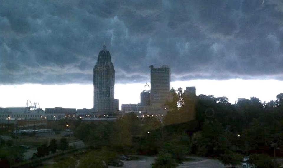
This photo is of Mammatus clouds over the Mobile, Alabama skyline last year.  Over the next few days, we may see more of these.