
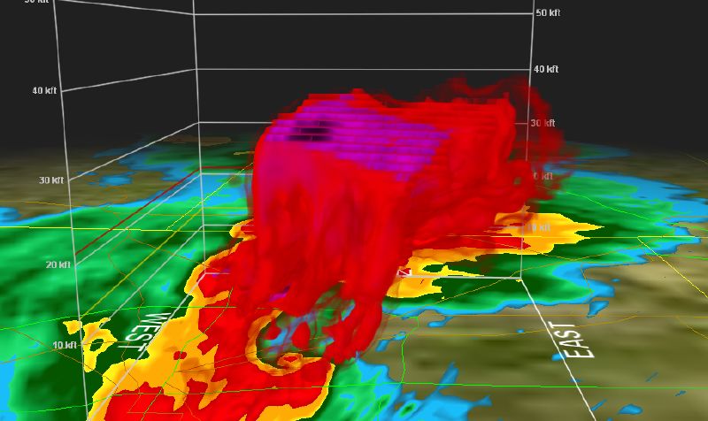
This image reflects the supercell that moved through the Dallas/Ft. Worth area earlier this evening.
Minor to moderate damage has been reported based on initial estimates. The NWS expects this line of storms to affect those in the Mississippi Valley and Tennessee Valley areas, and should provide a moderate to high risk for severe weather. Some forecasters are pridicting as much as 2″ hail even along the coastal areas.
As mentioned in an earlier entry, the activity poses a significant, if not imminent, threat for severe weather. A station out of Dallas confirmed initial damage but was unable to determine if said damage was from straight line winds or tornadic activity. In a brief moment of levity, I propose that if our houses are damaged/destroyed, we really are not going to care whether it was a funnel or straight line. Seriously, a long tracking Supercell storm will produce both, and often it is important to note and track both events.
Get you NOAA radios and make sure the batteries are good, as this has the potential to be a long night for many of us.