Day 50 – Oil Spill

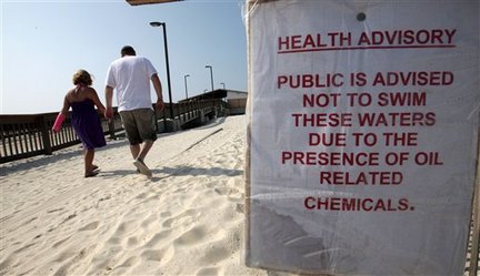
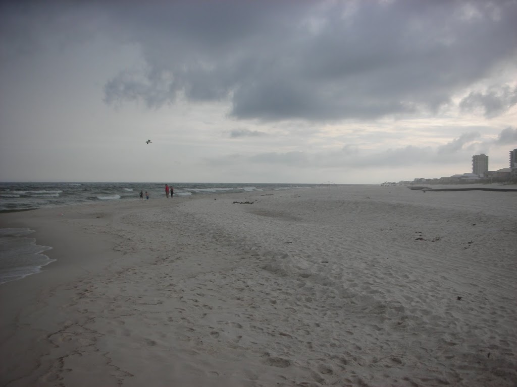
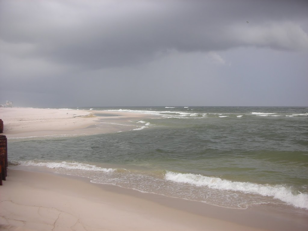
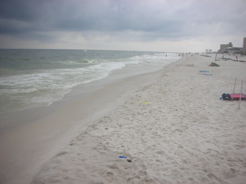
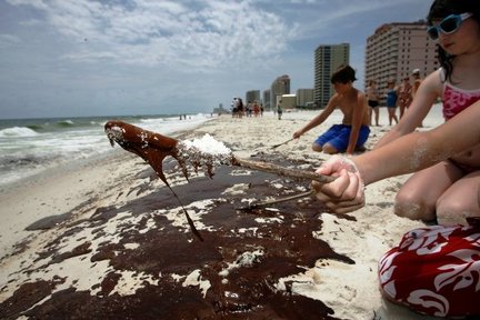
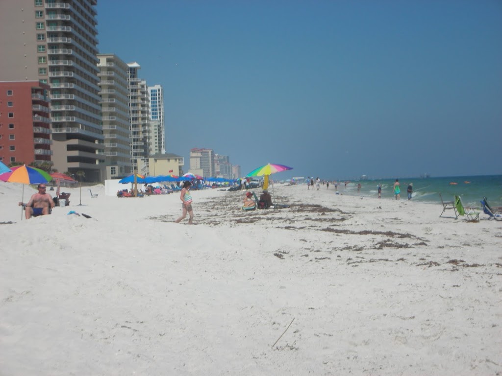
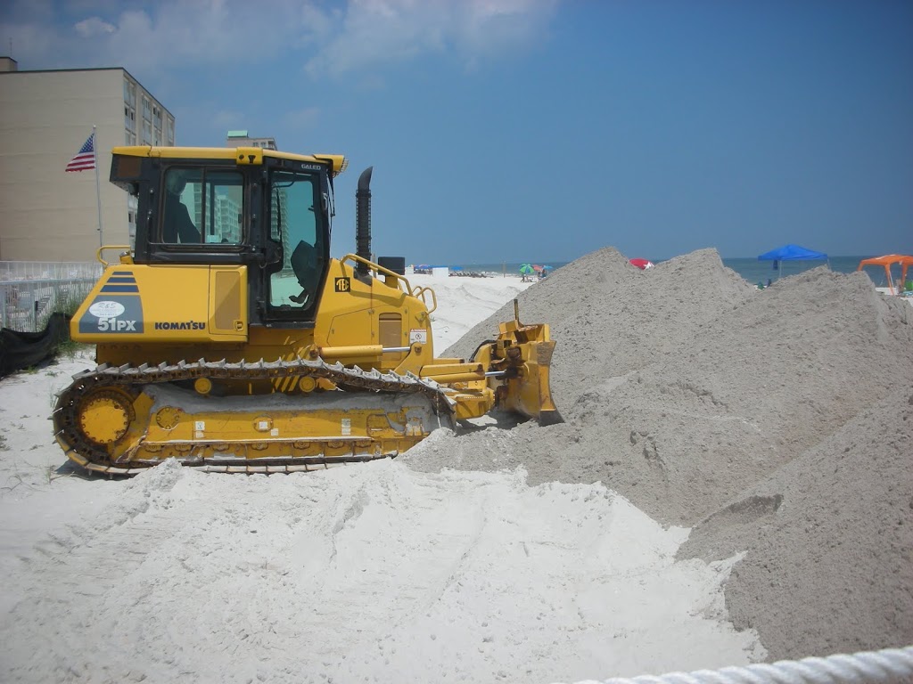
Isolated tar balls have been reported and rapidly cleaned, but for the most part the beaches remain clear and people were enjoying the sands and the water today. Given the nature of this blog, it is nice to report good news in what could become a complete disaster. As this slow-motion crisis evolves, we will continue to report. The final image, presented by http://www.wunderground.com/ paints an ominous picture of what is lurking in the Gulf of Mexico.


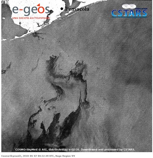
The oil spill on June 6, 2010 at 8:32pm EDT, as seen by Synthetic Aperture Radar (SAR) imagery from the Italian Cosmo-SkyMed (COnstellation of small Satellites for Mediterranean basin Observation) satellite. A large region of oil was a few miles offshore of Pensacola, Florida. Image credit: University of Miami Center for Southeastern Tropical Advanced Remote Sensing, Rosenstiel School of Marine and Atmospheric Science.


Additional Pictures

A view down the beach at Laguna Key.

The surf at Little Lagoon Pass. The thundershower in the distance was a rather loud one as it moved over the area.

A pelican watching the water for his next meal.

Gulf Shores Oil Spill

This picture depicts the sand barrier to “Little Lagoon Pass”, the barrier and the oil boons are in place to attempt to prevent the oil entering protected waters.

We have these pictures of our beaches and will update daily. The picture above was taken at Edgewater West, There were no traces of oil.

Oil Begins Showing

Oil has begun washing ashore in Gulf Shores Alabama. According to the Mobile Press/Register, attempts at cleanup have been unsuccessful. Orange Beach has reported tar balls as well. We will provide more information as it is available.

An “Oil’Cane”

From the current conditions in the Atlantic as well as conditions in the Gulf of Mexico, this season appears ripe for a major storm. The SST’s (Sea Surface Temperatures) are running higher than the past couple of hurricane seasons. Upper level shear is rather low, though we do expect that shear to increase later this summer off of the coast of Africa.

Sadly, the EPAC storm Agatha, while only a tropical storm, claimed over 90 lives in Guatemala. 150 and rising in Central America.
In the Northern areas of the Gulf of Mexico, the interest is on the blown well and the oil slicks and plumes traversing our waters. Dr. Jeff Masters has done some research about the possibilities, but reached the same conclusion we all have. We simply do not know.
What we do know is this: A major hurricane would be very bad. The oil spill is very bad.
A hurricane of any size will churn the water and hasten the dissipation of the oil. Would that create a doomsday scenario sending oil in the winds 10 miles inland?
I doubt it.
Would that event destroy our marshes?
I think so.
What we do know is this:
1) We have the potential for a strong hurricane season.
2) The plumes COULD affect any land falling storms in the Gulf of Mexico.
3) The oil and sheen could wreak havoc.
4) Based on the long term forecasts, we do have the option of a more aggressive season and we all have a new threat, yet, we should prepare as we do each year.

Hurricane Forecast. and Oil

Personal Note

As we gear up for this season, with the complications provided by the vast amounts of crude oil spilling into the Gulf, there are signs that cause me personal alarm. None of them have to do with the oil.
SST’s are high, and the Atlantic Jet is not looking good, but persistant high pressure systems near Africa could be to our benefit as presented.
This year presents a year for all of us to be especially watchful.
I will have a formal posting in the next few days.

2010 Tropical Storm Season Data

Good Day, everyone… for those who have been active here at the blog for several years, you already know about the postings that we place here from late May to mid December each year regarding Tropical Storm and Hurricane Tracking. We place unofficial advisories here for the benefit of viewers who may be in harms way along US coastal areas prone to Tropical Storms.

The 2010 Tropical Storm Season will run officially from June 01 to December 01. Our analysts are already refining our software and entering weather data into our analysis programs each day. If a tropical system forms and is NAMED by the National Hurricane Center in Miami, Florida, we will start our unofficial tracking and place specific storm details here in this Forum for the potential safety of our viewers, especially those in southern Baldwin County, Alabama. Our postings will include links to NOAA websites for minute by minute updates and we will also place a disclaimer in each of our posts mentioning that our advisories are not official. A copy of those details is included below in this initial seasonal posting – just for reference.

The EL NINO and LA NINA water temperature variations in the west central Pacific Ocean affect the formation of Atlantic, Caribbean and Gulf of Mexico storms. At this time, the Pacific El Nino is essentially neutral. That usually means that a slight warming of Atlantic waters may take place. Since tropical storms feed off of warm water, that can indicate an increased Atlantic basin storm activity in the early part of the season. We will be watching developing storms carefully and will post here accordingly. We are also facing a situation where Tropical Storms may interact with the Gulf oil spill and that will also be discussed as needed in this blog. Please refer to Acral’s oil spill updates.

Please use the first link below for Tropical System information and the second link below for active watches, warnings and data.

http://www.nhc.noaa.gov/

http://www.weather.gov/largemap.php

==================================================
“THIS IS NOT AN OFFICIAL ADVISORY. These updates and advisories are based upon information from our own computer models, NOAA, Local Weather Data Centers, deep water Buoy Data, and other publicly available sources. FOR THE SAFETY OF YOUR PROPERTY AND PERSON, please refer to your Local, State, and Federal Authority updates for Official Advisories and Orders. For up to the minute advisories and official updates, it is essential that you monitor your local Emergency Government, NOAA and Local Media Broadcasts. Please do not make personal safety decisions based upon information presented here in this Unofficial Advisory.”
==================================================

Update – Oil Spill

High winds and rough seas continue to hamper efforts at cleaning the spill, which means pur area could very likely see the effects of the spill.

At Friday’s County Meeting in Robertsdale, officials asked a BP representative several questions concerning the dangers posed to those of us who are coastal residents. Among the questions were…
“Will there be dangers from the fumes as the oil reaches the coast?” and “Should coastal residents need to evacuate?” The BP representative had no answers but wrote the questions down promised that a technical advisor would be dispatched as soon as possible.
The associated press reports: “The Coast Guard has estimated that about 200,000 gallons of oil are spewing out each day — which would mean 1.6 million gallons of oil have spilled since the April 20 explosion that killed 11 workers. The environmental mess could eclipse the Exxon Valdez disaster, when an oil tanker spilled 11 million gallons off Alaska’s shores in 1989.

The slick nearly tripled in just a day or so, growing from a spill the size of Rhode Island to something closer to the size of Puerto Rico, according to images collected from mostly European satellites and analyzed by the University of Miami.”

Oil Spill


Forecasters predict impact in our area as early as Sunday. If this threat materializes, we will provide information as to what precautions to take as well as where to obtain training to aid in the rescue of animals distressed by this event.

The following is a transcript of an email an associate was sent in regards to the potential necessity of rescuing wildlife in the areas affected:
We are trying to contact as many people as I have contact information for in the South Mississippi and South Alabama area regarding assistance in passing along critical information regarding the oil spill. Currently, the Pascagoula River Audubon Center is coordinating with other entities to assist in response to oil coming ashore in this area. We are attempting to get word out to the general public about what they are to do if they come in contact with an oiled/injured bird or animal. If you would please consider passing this along in whatever method you would like (email, facebook, phone, etc), it would be greatly appreciated. Here is the advice given:

Do not touch the bird or animal! The material is toxic to you! Call the Oiled Bird Hotline at 1-866-557-1401 and give the following information:

1 – where is the animal/bird located exactly
2 – your name
3 – your phone number
4 – your address

At this time, we are taking names to be added to a list of potential volunteers who would be willing to attend a training in dealing with oiled birds. This workshop has NOT been set yet, but we are on standby to provide names and numbers of willing participants. You may call 228/475-0825 and give your name and number. If that training is set, you will be contacted with details.

Thanks to all of you for considering passing this along to friends and family, and asking them to do the same.