Tropical Storm Erika

Tropical Storm Erika formed out of a tropical low pressure wave 450 miles east of the Leeward Islands over the past 9 hours. We have waited until this morning to post our first data about this storm because it is very disorganized and is moving in and out of Tropical Storm status with each overflight of the Hurricane Hunter Aircraft. At this hour, the storm is just northeast of the Leeward Islands as a minimal Tropical Storm. Projections and computer modeling are all over the board on this storm, but the general movement will be to the west-northwest for 3 to 5 days before an upper level system will start to affect it’s track. Persons in the Bahamas and from southeastern Florida to the Carolinas should watch this storm’s progress because it has some potential for strengthening. Our next unofficial update will take place as changing conditions warrant.

For Alabama Gulf Coast Residents: There is only one computer model out of 23 that is showing any southern Gulf of Mexico involvement. This storm has a high probability of being an east coast storm similar to ‘Danny’.

For official updates, please refer to:

http://www.nhc.noaa.gov/

==================================================

“THIS IS NOT AN OFFICIAL ADVISORY. These updates and advisories are based upon information from our own computer models, NOAA, Local Weather Data Centers, deep water Buoy Data, and other publicly available sources. FOR THE SAFETY OF YOUR PROPERTY AND PERSON, please refer to your Local, State, and Federal Authority updates for Official Advisories and Orders. For up to the minute advisories and official updates, it is essential that you monitor your local Emergency Government, NOAA and Local Media Broadcasts. Please do not make personal safety decisions based upon information presented here in this Unofficial Advisory.”

==================================================

Atlantic Tropical Outlook

Danny does not threaten to become a hurricane but requires the attention of interests along the East Coast. Another tropical wave, Invest 94L, off the coast of Africa has what the NHC determines to be a medium chance for development continues to move westward across the Atlantic.

The area of disturbed weather that affected our area earlier today was an Upper Level Low Pressue System, and did not pose a significant threat. Locally, our weather should be a bit clearer and warm a bit over the next few days.

We will continue watching T.S. Danny and 94L over the next few days and provide updates.

Tropical Storm Danny

Tropical Storm Danny formed in the Bahamas from a tropical low pressure area this morning. Danny is moving west-northwest at just under 20 MPH and may possibly strengthen to Hurricane Cat. 1 status within the next 18 to 36 hours. However, the upper level dynamics are changing hour by hour and Danny could remain only as a Tropical Storm.

Persons from southeastern Florida to the New England states along the US East Coast should monitor the progress of this storm carefully. Projected tracking and intensity could place Danny, as a low level hurricane, near the North Carolina/Virginia border Saturday morning, August 29. High surf, dangerous rip currents and lowlands flooding will preceed Danny as it approaches the US Coastline this weekend. While persons along the Gulf Coast will not be directly affected by this storm system, anyone with interests along the US East Coast should be watchfull of changing conditions.

Our next unofficial update will take place as conditions warrant. For official updates, please refer to:

http://www.nhc.noaa.gov/

==================================================

“THIS IS NOT AN OFFICIAL ADVISORY. These updates and advisories are based upon information from our own computer models, NOAA, Local Weather Data Centers, deep water Buoy Data, and other publicly available sources. FOR THE SAFETY OF YOUR PROPERTY AND PERSON, please refer to your Local, State, and Federal Authority updates for Official Advisories and Orders. For up to the minute advisories and official updates, it is essential that you monitor your local Emergency Government, NOAA and Local Media Broadcasts. Please do not make personal safety decisions based upon information presented here in this Unofficial Advisory.”

==================================================
Invest 92L

Invest 92L is just north of Peurtro Rico and has a good chance to develop. While there is no low level circulation at this point, and dry air as well as shear continues to inhibit development, this system should attain Tropical Storm status within the next 48 hours as it will enter a period of favorable conditions for a short time.

We will continue to monitor this system.

Hurricane Bill Update 06:30 AM EDT Saturday, August 22, 2009

Hurricane Bill continues on it’s generally northerly track. The storm has been changing intensity between Category 3 and Category 2 strength for the past 12 hours. The storm is currently due west of Bermuda and will be moving more to the north-northeast later today into Sunday. Persons along the entire east coast of the US can continue to expect extremely high surf with deadly rip currents, beach errosion and lowlands flooding. We are renewing our caution for beachgoers to stay out of the water!

Unless Hurricane Bill makes an unexpected track change, this will be our final Hurricane Bill unofficial update.

Please use this NOAA – NHC link for official advisories:

http://www.nhc.noaa.gov/

==================================================

“THIS IS NOT AN OFFICIAL ADVISORY. These updates and advisories are based upon information from our own computer models, NOAA, Local Weather Data Centers, deep water Buoy Data, and other publicly available sources. FOR THE SAFETY OF YOUR PROPERTY AND PERSON, please refer to your Local, State, and Federal Authority updates for Official Advisories and Orders. For up to the minute advisories and official updates, it is essential that you monitor your local Emergency Government, NOAA and Local Media Broadcasts. Please do not make personal safety decisions based upon information presented here in this Unofficial Advisory.”

==================================================

Hurricane Bill Update 06:30 AM EDT Thursday August 20

Hurricane Bill Update 06:30 AM EDT Thursday August 20, 2009

Hurricane Bill has weakened very slightly to a major Category 3 storm. The Atlantic High Pressure area has continued to move Bill in a northwesterly direction. The track is expected to move more northerly within 24 to 36 hours as it approaches Bermuda Friday into Saturday. Persons along the east coast of the US from the Georgia/South Carolina border to New England can expect to see higher than normal surf and tides over the next week or so along with some beach erosion and dangerous rip currents. While Bill will not be directly affecting residents along the Gulf of Mexico, anyone traveling to the East Coast should be aware of the possible coastal tide and surf conditions.

Persons visiting or vacationing in Bermuda are leaving on commercial flights and local residents are preparing for the storm at this hour.

We will update our unofficial information as conditions warrant.

Please use this NOAA – NHC link for official advisories:

http://www.nhc.noaa.gov/

==================================================

“THIS IS NOT AN OFFICIAL ADVISORY. These updates and advisories are based upon information from our own computer models, NOAA, Local Weather Data Centers, deep water Buoy Data, and other publicly available sources. FOR THE SAFETY OF YOUR PROPERTY AND PERSON, please refer to your Local, State, and Federal Authority updates for Official Advisories and Orders. For up to the minute advisories and official updates, it is essential that you monitor your local Emergency Government, NOAA and Local Media Broadcasts. Please do not make personal safety decisions based upon information presented here in this Unofficial Advisory.”

==================================================

Hurricane Bill Update 6 PM Eastern Time-Tuesday

HURRICANE BILL – 6:00 PM USA EDT, Tuesday, Aug. 18

Bill is at Category 4 – Major Hurricane strength at this hour. An upper level Atlantic High Pressure area is continuing to steer ‘Bill’ more to the northwest. However, a few of the tracking models are seeing another westerly shift IF the high pressure ridge mid-point moves past the track of ‘Bill’ and fails to allow it’s more northerly track. That possibility is statistically low, but it has been showing up as a constant in the recent track projections. At this time, we anticipate ‘Bill’ to continue on its northwest to north arc away from the US mainland, but if any changes to that track takes place, we will post accordingly.

For official updates, please refer to:

http://www.nhc.noaa.gov/

==================================================

“THIS IS NOT AN OFFICIAL ADVISORY. These updates and advisories are based upon information from our own computer models, NOAA, Local Weather Data Centers, deep water Buoy Data, and other publicly available sources. FOR THE SAFETY OF YOUR PROPERTY AND PERSON, please refer to your Local, State, and Federal Authority updates for Official Advisories and Orders. For up to the minute advisories and official updates, it is essential that you monitor your local Emergency Government, NOAA and Local Media Broadcasts. Please do not make personal safety decisions based upon information presented here in this Unofficial Advisory.”

==================================================

Hurricane Bill

Hurricane Bill is expected to reach Catagory Three status and could pose a threat to the East Coast of the U.S. Meanwhile, Ana has been downgraded to a tropical depression.

The NHC has this to say about Ana:

THIS IS THE LAST PUBLIC ADVISORY ISSUED BY THE NATIONAL HURRICANE
CENTER ON THIS SYSTEM. ADDITIONAL INFORMATION ON THIS SYSTEM CAN
BE FOUND IN HIGH SEAS FORECASTS ISSUED BY THE NATIONAL WEATHER
SERVICE…UNDER AWIPS HEADER NFDHSFAT1 AND WMO HEADER FZNT01 KWBC.

-=-=-=-=-=-
You can now get updates via Twitter from us.. simply follow “Acral” on your mobile device.

T.S. Claudette

Tropical Storm Claudette has formed and is nearing landfall on the Florida panhandle. Portions of Alabama and Florida should feel the effects of Claudette today through at least Tuesday. Ana and Bill maintain their westward march.

Ana has weakened somewhat, but should re-strengthen as she moves cloaser to the Gulf of Mexico.

Tropical Storms – Bill and Ana

Tropical Storm Ana and Bill continue their westward advancement in the Atlantic.
The SAL and SST’s are favorable for development and the shear battling Ana should lessen.
Ana remains a small storm, but is predicted to develop over the next few days and has a good chance of reaching hurricane status. Bill, on the other hand, is a larger storm, with conditions more favorable for continued development. Bill has the potential to become a major hurricane, reaching Catagory 3 or higher. Bill is tracking roughly a thousand miles behind Ana, and both could emerge into the Gulf of Mexico.
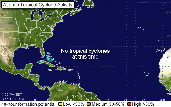
An area of disturbance in the south east Gulf of Mexico bears watching, although the potential for development remains at less than 30% as evidenced in the NOAA/NHC graphic above. Currently, this system is expected to be a rain maker for the north east Gulf Coast. Some severe weather could result from this system as it approaches land.
Elsewhere in the tropics, a strong tropical wave has moved off the coast of Africa, bringing the potential for development. We will have further updates and information as these systems continue to progress.