November 30, 2009 – Official end of the 2009 Hurricane Season

November 30, 2009 – This is the official end of the 2009 Atlantic Basin Hurricane Season.

We thank everyone who has followed our postings this year and we sincerely hope that the 2010 season, starting June 01, 2010, will be as mild as this season has been.

Thank you… and we’ll be back with hurricane preparedness information once again in May 2010.

Between now and June 01, 2010 – if any regional weather issues develop that would be of interest to the residents of Baldwin, Mobile and Escambia Counties, we will bring you any important details as needed.

Curfew from 10pm until to 6am

Baldwin County officials have imposed a curfew from 10pm until 6am this morning.

Conditions here continue to deteriorate as Ida moves inland, howe

ver, at initial glance there does not appear to be much damage, nor do we see a potential for anything other than minor, isolated, damage. We will continue to monitor the storm as it moves across the Gulf Shores/Orange Beach area.
Current Conditions: 3.62 inches of rain, averaging 1.4 inches per hour, sustained winds of 30 mph with one gust recorded at this station of 41 mph. In the time it has taken to write this, (which is not long) we are now up to 3.90 inches of rain.
Rainfall is expected to continue for the next 3 to 4 hours and should begin tapering off. Winds should continue to increase over the next two hours. As Jim Cantore mentioned (The Weather Channel) as the winds increase we could see a combination of saturated grounds and spotty power outages throughout the area.

Hurricane Ida

While it remains to early to get a good feel on the destination of Ida, early indicators suggests that areas from Mobile County, Baldwin County, and Escambia County (FL) will likely face tropical storm to hurricane conditions with the next 72 hours.

>> HURRICANE IDA <<

HURRICANE IDA is now near the Yucatan Penninsula of Mexico moving generally north at 12 miles per hour into the Gulf of Mexico. This storm is currently at Category 1 with sustained winds at 90+ MPH and will strengthen to Category 2 later Sunday, Nov. 08. The storm will encounter an upper level system which may keep it from strengthening further, but we are carefully watching this system for interaction with Hurricane Ida. Persons from the Texas – Louisiana border to southwestern Florida should monitor the progress of this storm very carefully. There are many variables which could affect this Hurricane’s path and intensity over the next 3 days and the link below can be used for hour by hour updating. Listen carefully to your local Weather Office and Emergency Operations Center advisories if you are in coastal Louisiana, Mississippi, Alabama and Florida.

For official updates, please refer to:

http://www.nhc.noaa.gov/

==================================================

“THIS IS NOT AN OFFICIAL ADVISORY. These updates and advisories are based upon information from our own computer models, NOAA, Local Weather Data Centers, deep water Buoy Data, and other publicly available sources. FOR THE SAFETY OF YOUR PROPERTY AND PERSON, please refer to your Local, State, and Federal Authority updates for Official Advisories and Orders. For up to the minute advisories and official updates, it is essential that you monitor your local Emergency Government, NOAA and Local Media Broadcasts. Please do not make personal safety decisions based upon information presented here in this Unofficial Advisory.”

Named Storm Ida

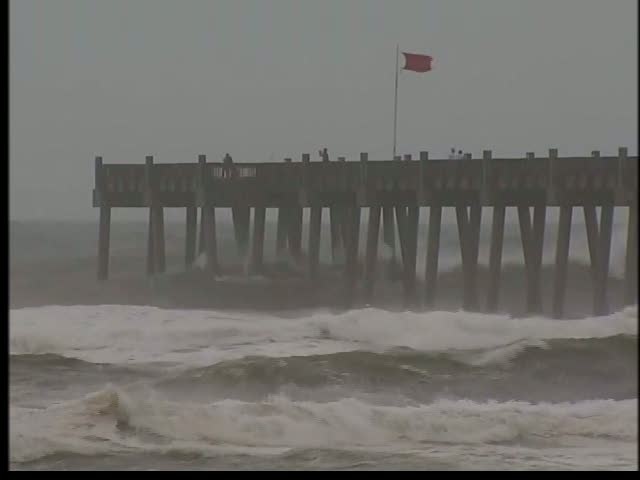
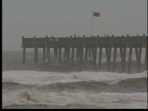
Tropical Storm Ida formed out of a tropical depression in the western Caribbean within the past 15 hours. This storm developed quickly and is near Hurrican force, Category 1 at this time. The storm is affecting the Central America east coast with significant rains and wind. This will cause mudslides throughout the mountainous areas, especially in Nicaragua. The storm will weaken as it brushes the coastline and will probably enter the southern Gulf of Mexico near the Yucatan Penninsula Monday or Tuesday as a tropical depression or weak tropical storm. There is a chance that the storm will re-form and strengthen again in 5 to 7 days once it gets into the warm Gulf of Mexico waters. Persons along the Gulf Coast of the USA should watch this storm’s progress.

Our next unofficial update will take place if and when this storm shows signs of being a threat to the Gulf Coast states.

For official updates, please refer to:

http://www.nhc.noaa.gov/

==================================================

“THIS IS NOT AN OFFICIAL ADVISORY. These updates and advisories are based upon information from our own computer models, NOAA, Local Weather Data Centers, deep water Buoy Data, and other publicly available sources. FOR THE SAFETY OF YOUR PROPERTY AND PERSON, please refer to your Local, State, and Federal Authority updates for Official Advisories and Orders. For up to the minute advisories and official updates, it is essential that you monitor your local Emergency Government, NOAA and Local Media Broadcasts. Please do not make personal safety decisions based upon information presented here in this Unofficial Advisory.”