2017 Tropical Storm Season winding down…

After several US landfalls since August, there may be a pause in storm formation for now.  We are providing the link to the National Hurricane Center for current information and any archived storm data for the 2017 season.

That being said, we are still monitoring all areas where Atlantic Basin storms form, in case any late season storms were to develop.

Please use the link below to the National Hurricane Center in Miami, for official information on all named tropical origin storms.

http://www.nhc.noaa.gov/       

================================================

“These are not official advisories. These updates and advisories are based upon information from our own computer models, NOAA, Local Weather Data Centers, deep water Buoy Data, and other publicly available sources. FOR THE SAFETY OF YOUR PROPERTY AND PERSON, please refer to your Local, State, and Federal Authority updates for Official Advisories and Orders. For up to the minute advisories and official updates, it is essential that you monitor your local Emergency Government, NOAA and Local Media Broadcasts. Please do not make personal safety decisions based upon information presented here.”

https://gulfstorm.net

Tropical Storm Research Center, Gulf Shores, Alabama

===========================================

Named Storm Philippe – 2017

Named Storm Philippe formed in the western Caribbean from a Tropical Depression.   Persons in Florida south of a line from Fort Meyers to Vero Beach should be monitoring the progress of this storm this weekend for some heavy rain, gusty wind, high surf and some tornadoes. This is a quick moving storm, so due to the limited US coastal involvement of this storm, this will be our only unofficial advisory.

For information on all named Tropical Storms or Hurricanes, use the link below to the National Hurricane Center.

http://www.nhc.noaa….oaa.gov/       

================================================

“These are not official advisories. These updates and advisories are based upon information from our own computer models, NOAA, Local Weather Data Centers, deep water Buoy Data, and other publicly available sources. FOR THE SAFETY OF YOUR PROPERTY AND PERSON, please refer to your Local, State, and Federal Authority updates for Official Advisories and Orders. For up to the minute advisories and official updates, it is essential that you monitor your local Emergency Government, NOAA and Local Media Broadcasts. Please do not make personal safety decisions based upon information presented here.”

https://gulfstorm.net

Tropical Storm Research Center, Gulf Shores, Alabama

===========================================

Named Storm Ophelia – 2017

Named Storm Ophelia formed in the central Atlantic from a tropical low pressure area.  This storm will increase in intensity to hurricane status but since it will remain in the Atlantic and move away from the US, this will be our only mention of this storm.

For information on all named Tropical Storms or Hurricanes, use the link below to the National Hurricane Center.

http://www.nhc.noaa.gov/       

================================================

“These are not official advisories. These updates and advisories are based upon information from our own computer models, NOAA, Local Weather Data Centers, deep water Buoy Data, and other publicly available sources. FOR THE SAFETY OF YOUR PROPERTY AND PERSON, please refer to your Local, State, and Federal Authority updates for Official Advisories and Orders. For up to the minute advisories and official updates, it is essential that you monitor your local Emergency Government, NOAA and Local Media Broadcasts. Please do not make personal safety decisions based upon information presented here.”

https://gulfstorm.net

Tropical Storm Research Center, Gulf Shores, Alabama

===========================================

Hurricane Nate unofficial update – October 7, 2017

All official agency tracking models, as well as our own, are showing a landfall as a high Category 1 or Category 2 hurricane. The area between the Mississippi/Louisiana border east to Panama City, Florida, will see the highest probability of direct impact later Saturday, October 7, into early Sunday, October 8. Persons in this area of the Gulf Coast can expect to see a storm surge of up to 10 feet as well as 15 to 21 foot waves on top of that. Winds near the eyewall could gust to over 120 MPH and tropical storm winds will be felt out to 70 miles from the center of lowest low pressure. We are requesting that all persons in this affected area follow any mandatory evacuation orders. Lowlands flooding, power outages, heavy rainfall over 6 inches and damage to buildings can be expected. Please review posts below this one.
 
For official storm updates, use the link below to the National Hurricane Center in Miami. Take care and be safe.
 
 
================================================
 
“These are not official advisories. These updates and advisories are based upon information from our own computer models, NOAA, Local Weather Data Centers, deep water Buoy Data, and other publicly available sources. FOR THE SAFETY OF YOUR PROPERTY AND PERSON, please refer to your Local, State, and Federal Authority updates for Official Advisories and Orders. For up to the minute advisories and official updates, it is essential that you monitor your local Emergency Government, NOAA and Local Media Broadcasts. Please do not make personal safety decisions based upon information presented here.”
 
 
Tropical Storm Research Center, Gulf Shores, Alabama
 
===========================================
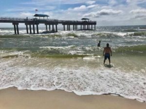
Current Conditions at Orange Beach

The Gulf waters and churning at Cotton Bayou in Orange Beach.  Conditions are expected to deteriorate as early as Saturday afternoon.

The surf will continue to rise throughout Saturday night and into Sunday.

Named Storm Nate – 2017

We are updating our previous information on this storm system to include the official name and to now include Louisiana in the advisory area, due to a slight westerly shift in the cone of probability as the result of interaction this weekend with an inland cold front.

Review the information provided in the two posts below this one.

Please use the link below to the National Hurricane Center in Miami, for official information on all named tropical origin storms.

http://www.nhc.noaa.gov/       

================================================
“These are not official advisories. These updates and advisories are based upon information from our own computer models, NOAA, Local Weather Data Centers, deep water Buoy Data, and other publicly available sources. FOR THE SAFETY OF YOUR PROPERTY AND PERSON, please refer to your Local, State, and Federal Authority updates for Official Advisories and Orders. For up to the minute advisories and official updates, it is essential that you monitor your local Emergency Government, NOAA and Local Media Broadcasts. Please do not make personal safety decisions based upon information presented here.”

https://gulfstorm.net

Tropical Storm Research Center, Gulf Shores, Alabama

===========================================
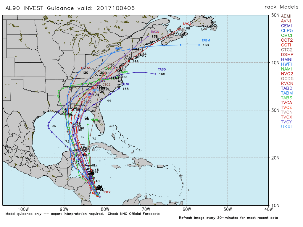
Unofficial Advisory for Tropical Depression 16 – 2017

Tropical Depression 16 is located off the east coast of Nicaragua in the western Caribbean.  This area of low pressure is forecast to move generally northerly and will most likely become Named Tropical Storm Nate – 2017 within 24 hours.  Since this storm will be going into favorable conditions for development over the next couple of days, we are posting this unofficial advisory for persons in Florida, Alabama, Georgia and Mississippi to watch the progress of this storm carefully. We are also recommending that persons in these listed states be prepared for a possible Sunday, October 8  landfall as a strong Tropical Storm or even a Category 1 or 2 Hurricane. 

Please use the link below to the National Hurricane Center in Miami, for official information on all named tropical origin storms.

http://www.nhc.noaa.gov/       

================================================

“These are not official advisories. These updates and advisories are based upon information from our own computer models, NOAA, Local Weather Data Centers, deep water Buoy Data, and other publicly available sources. FOR THE SAFETY OF YOUR PROPERTY AND PERSON, please refer to your Local, State, and Federal Authority updates for Official Advisories and Orders. For up to the minute advisories and official updates, it is essential that you monitor your local Emergency Government, NOAA and Local Media Broadcasts. Please do not make personal safety decisions based upon information presented here.”

https://gulfstorm.net

Tropical Storm Research Center, Gulf Shores, Alabama

===========================================