
The low that brought much of the region rain over the past few days has moved off shore and is showing signs of rotation.
The NHC is planning a recon flight into the low to ensure that we do not end up staring at another Charley. The 18z NAM shows this becoming an Alabama system, bringing rain and thunderstorms to the coastal areas.
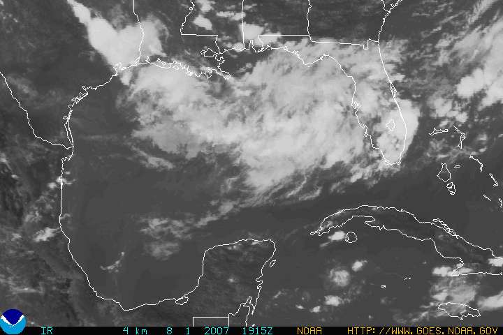
Right now, the jury is out on whether it becomes a tropical system in the Gulf of Mexico. You can see it here: http://www.goes.noaa.gov/HURRLOOPS/gulfvs.html. The image above is a still image of the visible satellite loop. A personal, and most definately not a professional assesment suggests that while this Low Pressure System could become a tropical storm over the next 48 hours, chances are it will remain a simple rain maker for much of the central coastal areas.
Elsewhere, Invest 99L recon flight is complete, and there is no closed rotation or vortex message, which means this systems remains a tropical wave and NOT a tropical depression. Some improvement of Invest 99L is possible over the next 48 hours.
Tropical Storm Chantal is still chugging merrily north and not doing much more and startling a rogue fish or two.
Of note, the Mobile NWS office issued a statement calling for increased off-shore winds through Friday and building seas.
From BMX to MOB, nearly all forcasters are calling this blob something to watch. Models show landfall ranging from Texas to Panama City, FL, with no clear consensus.
Virtually all of the forecasters hint at some possibility of development over the next day or so.