Major ‘Cane Earl – TS Danille – TS Fiona

Major Hurricane Earl has already surpassed Danielle when she was at her strongest. Earl is undergoing a Rapid Intensification Cycle and should be a strong Catagory Four hurricane this evening. Meanwhile, Danielle continues to weaken and invest 97L has become Tropical Storm Fiona, currently following on Earl’s heels.

With the current models, the entire Eastern US seaboard from Savannah through New England lie withing the impact cone of Earl. Models have trended slightly west before showing a re-curve to the north. Depending on how far west Earl travels, the greater the likelihood for impact on the East Coast of the US.

Hurricane Earl Update Sunday Aug. 29

Hurricane Earl Update Sunday, August 29, 2010 – 11:00 Hrs CDT

Earl was classified as a Category 1 Hurricane earlier today. Persons in the Leeward Islands, Hisapaniola and Puerto Rico are under Hurricane watches and warnings for major Hurricane involvement (Category 3 or higher). The storm track is still developing due to interaction with both low level and upper level winds, but most computer modeling is showing a track to the west of Bermuda and then northerly with some US east coastal issues from northeastern Georgia to New England from late Thursday September 02 through next weekend.

Persons from south Florida to New England should be monitoring the development of this significant storm event.

For up to the minute official advisories and information, please visit the NHC website in Miami

http://www.nhc.noaa.gov/

=============================================

“THIS IS NOT AN OFFICIAL ADVISORY. These updates and advisories are based upon information from our own computer models, NOAA, Local Weather Data Centers, deep water Buoy Data, and other publicly available sources. FOR THE SAFETY OF YOUR PROPERTY AND PERSON, please refer to your Local, State, and Federal Authority updates for Official Advisories and Orders. For up to the minute advisories and official updates, it is essential that you monitor your local Emergency Government, NOAA and Local Media Broadcasts. Please do not make personal safety decisions based upon information presented here in this Unofficial Advisory.”

============================================

Named Storm Earl (Please Review Comment # 1 below)

Tropical Storm Earl formed southwest of the Cape Verde Islands from a Tropical Depression today. This storm will follow in the ‘footsteps’ of Hurricane Danielle, but in 3 to 4 days, it will be acted upon by upper level steering currents and will push the storm much farther west and possibly into the Caribbean Sea near Puerto Rico early next week. Our computer modeling for ‘Earl’ is showing a possible southeastern US involvement into the middle of next week and weekend, but it is very early in the process for accurate tracking. Our modeling will be refined each day and we will post unofficial details as conditions warrant. We are also tracking an intense Tropical Wave that just came off the west African coast and this low pressure area may become named storm ‘Fiona’ within the next 36 hours.

Note: IF the anticipated track of Hurricane Danielle moves any farther to the west threatening New England, we will update that posting thread accordingly. As of this posting, Danielle is moving as predicted.

For up to the minute official advisories and information, please visit the NHC website in Miami

http://www.nhc.noaa.gov/

=============================================

“THIS IS NOT AN OFFICIAL ADVISORY. These updates and advisories are based upon information from our own computer models, NOAA, Local Weather Data Centers, deep water Buoy Data, and other publicly available sources. FOR THE SAFETY OF YOUR PROPERTY AND PERSON, please refer to your Local, State, and Federal Authority updates for Official Advisories and Orders. For up to the minute advisories and official updates, it is essential that you monitor your local Emergency Government, NOAA and Local Media Broadcasts. Please do not make personal safety decisions based upon information presented here in this Unofficial Advisory.”

============================================

Named Storm Danielle

For persons with vacation plans in Bermuda or who have interests along the east coast of the US:

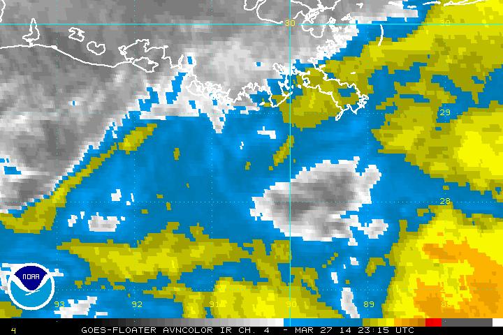
Tropical Storm Danielle formed out of Tropical Depression # 6 just southwest of the Cape Verde Islands in the east central Atlantic early Monday, August 23. Conditions in the central Atlantic are favorable for intensification and this Tropical Storm will become a Hurricane within 12 to 18 hours. Due to upper level flow, this storm will be taken in a northwesterly direction for several days and then a more northerly path to the east of Bermuda and into the north central Atlantic. Most of our computer modeling is not showing a US east coast involvement, however, the timing of the next frontal area exiting the east coast could possibly alter the track of this storm a bit to the west. Our modeling is taking this possibility into consideration and we are watching this closely.

Our next unofficial update concerning named storm Danielle will be posted as conditions warrant.

For up to the minute official advisories and information, please visit the NHC website in Miami

http://www.nhc.noaa.gov/

=============================================

“THIS IS NOT AN OFFICIAL ADVISORY. These updates and advisories are based upon information from our own computer models, NOAA, Local Weather Data Centers, deep water Buoy Data, and other publicly available sources. FOR THE SAFETY OF YOUR PROPERTY AND PERSON, please refer to your Local, State, and Federal Authority updates for Official Advisories and Orders. For up to the minute advisories and official updates, it is essential that you monitor your local Emergency Government, NOAA and Local Media Broadcasts. Please do not make personal safety decisions based upon information presented here in this Unofficial Advisory.”

============================================

Please Review the Comment update Below –

Atlantic Conditions Changing

Our Research Center has noted that the conditions in the south central and east central Atlantic are becoming favorable for Tropical Cyclone formation. We are watching areas of Tropical Waves southwest of the Cape Verde Islands as well as southwest of the Azores which may be upgraded to Tropical Depressions or Tropical Storms within the next 3 to 7 days.

Please watch for updates here in the blog because a slightly higher risk of storm formation is now in place.

TD 5 – DISSAPATED

The National Hurricane Center cancled the Hurricane Hunter flight this afternoon and reports that TD 5 has dissapated. There will be no further advisories concerning this system.

-=-=-=-=-=-=-=-=-=-=-=-=-=-=-=-=-=-

Historical Reference:

Tropical Depression 5 has formed from a low pressure system in the Gulf of Mexico. Sea Surface Temperatures (SST’s) are extremely conducive for strengthening, however, potential Danielle has two hurdles to overcome: a short time over water before landfall, and dry air entering the system. These factors should inhibit TD5 from intensifying much beyond Tropical Storm strength.


There is a possibility that TD5 could stall prior to landfall, which would give it more opportunity to gain strength. A tropical storm WARNING has been issued for the northern Gulf Coast. Gulf Shores, Orange Beach, Perdido Key, and surrounding areas can expect to see Tropical Storm conditions as early as tomorrow night. Coastal areas and low lying areas should be on the lookout for flooding. TD5 will also carry a risk of tornadoes and severe storms as the bands encounter instability in the upper atmosphere as TD5 comes ashore.

We will have additional updates around 6:00am CDT and throughout the day Wednesday.

Trouble Lurking for the Northern Gulf ?


Our studies and research group is carefully monitoring a developing low pressure area off the Florida Keys at this hour. This Gulf low is drawing energy from the extremely warm Gulf surface waters and may become a named Tropical Storm fairly soon.

Gulf Coastal residents from Panama City, Florida to New Orleans, Louisiana should monitor the progress of the developing system closely.

We will place an update here in the blog as conditions warrant regarding this Gulf low pressure area.

We are also monitoring a tropical low 800 miles north northeast of the Leeward Islands. It has some potential to increase in intensity and to affect the southeastern US in a week to 10 days.

For official updates and advisories please use the link below at the National Hurricane Center in Miami.

http://www.nhc.noaa.gov/

=============================================

“THIS IS NOT AN OFFICIAL ADVISORY. These updates and advisories are based upon information from our own computer models, NOAA, Local Weather Data Centers, deep water Buoy Data, and other publicly available sources. FOR THE SAFETY OF YOUR PROPERTY AND PERSON, please refer to your Local, State, and Federal Authority updates for Official Advisories and Orders. For up to the minute advisories and official updates, it is essential that you monitor your local Emergency Government, NOAA and Local Media Broadcasts. Please do not make personal safety decisions based upon information presented here in this Unofficial Advisory.”

============================================

TS Colin has Returned

Tropical Storm Colin appeared to all but dissipate over the past few days, but new imagery suggests that the remnants of Colin are starting to develop again. The NHC gives the system a 70% chance of reaching Tropical status in the next 48 hours. The low pressure system is exhibiting circulation, as well as tropical storm force winds on the north side. An Airforce Hurricane Hunter is scheduled to investigate this afternoon.

Elsewhere in the tropics, there are several areas that merit attention, though none are expected to develop significantly in the next 48 hours.
The recon flight has confirmed that TS Colin has regained tropical storm status. Advisories from the NHC and Weather.gov point out that over the past two days track variances have been 200 NM on Day 4 and 250 NM on Day 5. This means that the forecast track has been off the past two days; throwing a cloud of uncertainty as to the path. Additionally, wind speed projects have been off by as much as 20 knots.

Named Storm Colin

Tropical Storm Colin formed in the mid Atlantic early this morning out of Tropical Depression # 4. Our track modeling is showing a mainly northwesterly path to the north of Jamaica and to the east of the Bahamas by this weekend. A fairly strong upper level low pressure area to the north of Tropical Storm Colin will introduce wind shear in the upper levels and will lessen the possibility of this storm from developing. The forward motion of Tropical Storm Colin is between 20 and 25 miles per hour, which is not allowing the storm to feed itself off the warm waters that it is traveling over and further reducing the possibility of development.

This storm will most likely remain a ‘fish storm’ – staying out over the Atlantic, as it takes it’s northerly swing off the US southeast and east coast after this weekend. There is one computer model showing a much farther westerly component to this storm and we will be watching the actual track closely. If the storm moves farther west, as a high pressure area over the US south moves easterly, there may be some storm interaction. This possibility could cause the storm to slow and to intensify, but that possibility at this time is not high.

For official updates and advisories please use the link below at the National Hurricane Center in Miami.

http://www.nhc.noaa.gov/

=============================================

“THIS IS NOT AN OFFICIAL ADVISORY. These updates and advisories are based upon information from our own computer models, NOAA, Local Weather Data Centers, deep water Buoy Data, and other publicly available sources. FOR THE SAFETY OF YOUR PROPERTY AND PERSON, please refer to your Local, State, and Federal Authority updates for Official Advisories and Orders. For up to the minute advisories and official updates, it is essential that you monitor your local Emergency Government, NOAA and Local Media Broadcasts. Please do not make personal safety decisions based upon information presented here in this Unofficial Advisory.”

============================================