Good Day, everyone… for those who have been active here at the blog for several years, you already know about the postings that we place here from late May to mid December each year regarding Tropical Storm and Hurricane Tracking. We place unofficial advisories here for the benefit of viewers who may be in harms way along US coastal areas prone to Tropical Storms.
The 2010 Tropical Storm Season will run officially from June 01 to December 01. Our analysts are already refining our software and entering weather data into our analysis programs each day. If a tropical system forms and is NAMED by the National Hurricane Center in Miami, Florida, we will start our unofficial tracking and place specific storm details here in this Forum for the potential safety of our viewers, especially those in southern Baldwin County, Alabama. Our postings will include links to NOAA websites for minute by minute updates and we will also place a disclaimer in each of our posts mentioning that our advisories are not official. A copy of those details is included below in this initial seasonal posting – just for reference.
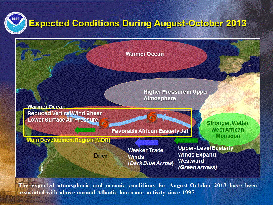
The EL NINO and LA NINA water temperature variations in the west central Pacific Ocean affect the formation of Atlantic, Caribbean and Gulf of Mexico storms. At this time, the Pacific El Nino is essentially neutral. That usually means that a slight warming of Atlantic waters may take place. Since tropical storms feed off of warm water, that can indicate an increased Atlantic basin storm activity in the early part of the season. We will be watching developing storms carefully and will post here accordingly. We are also facing a situation where Tropical Storms may interact with the Gulf oil spill and that will also be discussed as needed in this blog. Please refer to Acral’s oil spill updates.
Please use the first link below for Tropical System information and the second link below for active watches, warnings and data.
http://www.nhc.noaa.gov/
http://www.weather.gov/largemap.php
==================================================
“THIS IS NOT AN OFFICIAL ADVISORY. These updates and advisories are based upon information from our own computer models, NOAA, Local Weather Data Centers, deep water Buoy Data, and other publicly available sources. FOR THE SAFETY OF YOUR PROPERTY AND PERSON, please refer to your Local, State, and Federal Authority updates for Official Advisories and Orders. For up to the minute advisories and official updates, it is essential that you monitor your local Emergency Government, NOAA and Local Media Broadcasts. Please do not make personal safety decisions based upon information presented here in this Unofficial Advisory.”
==================================================