
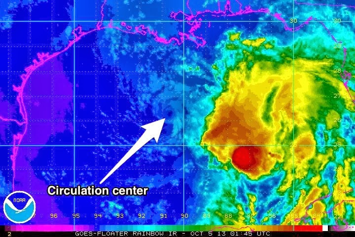
KAREN HAS BEEN DECAPITATED BY STRONG SOUTHWESTERLY SHEAR AND NOW
CONSISTS OF A VERY TIGHT SWIRL OF LOW CLOUDS WITH SOME LINEAR
CONVECTION TO THE EAST OF THE CENTER.
That was the wording in one of the discussions from the National Hurricane Center. High wind shear and dry air flowing into the western side of the storm have all but removed activity from the center of circulation.
This year has been different, but in a good way, as virtually every named storm has been shredded by dry air or shear, and in this case, both. Of course, coastal surge, localized flooding, and inland storms with isolated tornadoes remain a concern, but a central “direct hit” from a tropical system appears unlikely. Essentially, this system is D.O.A., which is a good thing.
We are monitoring a couple of other possible events and will post information as needed. Be advised, that the remnants of Karen will bring heavy rain, gusty winds, and some potential for isolated tornadoes as the cold front sweeps them up, possibly in North-Central Alabama, Georgia, and South Carolina.
We will continue to monitor “Karen” but I expect our final advisory will be issued in the morning.