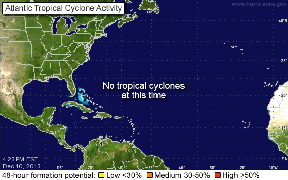
See the comments below Gary’s post—T.S. Hanna has formed in the Central Atlantic. Initial estimates suggest a potential threat to the east coast. I’ll have a more complete update on both systems later this afternoon.
Gustav Has Company
Early this morning, Tropical Depression # 8 formed in the western Atlantic. This Tropical Depression will intensify over the next couple of days and will start affecting the East Coast of the US by September 05 – 10 with increasing winds, rip currents and high surf. We are tracking this developing storm as well as Gustav and three other tropical waves of interest. There is some concern at this early date that Gustav and the intensified Tropical Depression # 8 (Possibly named Hanna) may merge in the southeastern US and create significant coastal and inland flooding into the second week of September depending upon forward movement of both storms.
At this hour, Tropical Storm Gustav is nearly at Categiory 1 Hurricane strength again and our next update here will most likely reflect that increase. Most of the tracking models are in general agreement and we are watching these, as well as our own, very closely.
Persons in coastal east Texas, Louisiana, Mississippi, Alabama and northwestern Florida should be on alert regarding Gustav. Please monitor your local Emergency Operations Centers through local media for official advisories.
Use the first link below for Tropical System information and the second link below for active watches, warnings and data.
http://www.nhc.noaa.gov/
http://www.weather.gov/largemap.php
================================================== =======
“THIS IS NOT AN OFFICIAL ADVISORY. These updates and advisories are based upon information from our own computer models, NOAA, Local Weather Data Centers, deep water Buoy Data, and other publicly available sources. FOR THE SAFETY OF YOUR PROPERTY AND PERSON, please refer to your Local, State, and Federal Authority updates for Official Advisories and Orders. For up to the minute advisories and official updates, it is essential that you monitor your local Emergency Government, NOAA and Local Media Broadcasts. Please do not make personal safety decisions based upon information presented here in this Unofficial Advisory.”
================================================== =======
Gustav Expected to Strengthen
![]()
The National Hurricane Center expects Gustav to strengthen to a Category 3+ hurricane in the  Gulf of Mexico. The models, as evidenced in the graphic vary greatly, but the current thought is a potential landfall in or near Louisiana. Our area remains in the potential cone of impact.
Preparations should begin NOW. The graphic to the right depicts the intensity forecast, nearly all of the models bring Gustav to a Catagory 3 or higher. The unofficial word is that portions of Louisiana are considering evacuations as early as Saturday. With this storm encroaching, travelers over the holiday weekend should be especially diligent and monitor this storm closely.
Gustav Has Weakened
The mountainous regions of Haiti have taken their toll on Gustav. Models indicate that Gustav should pass just to the south of Cuba, but the mountains in southwester Cuba could limit Gustav’s strengthening over the next few days.
The models remain divergent with Gustav, with some bringing him towards Mexico. Trending and analysis suggests a potential threat from the Tex/Mex border to the entire coast of Lousiana. Outlier models are still hinting at a strong recurve north and placing portions of the Florida Panhandle at risk.
 It remains to early to tell. The interaction with Cuba and subsequent emergence into the Gulf of Mexico should give us a better handle on this system.
Historically, this storm, as Pastor Gary and I discussed, is very reminiscent of Hurricane Dennis. Gustav remains a small storm, with a small windfield. The favorable conditions in the Gulf of Mexico could promote explosive development. The storm remains a very serious threat to U.S. interests.
Hurricane Gustav
Hurricane Gustav still has the islands to contend with, but should emerge into the Gulf of Mexico as a Hurricane.
It is to early to predict final landfall, but the northen Gulf of Mexico should closely monitor this storm.
Tropical Storm Gustav
The depression we discussed earlier today has been upgraded to Tropical Storm Gustav, after data from the Hurricane Hunter mission was analyzed from the flight this afternoon. The graphics under the heading Tropical Depression 7 indicate the location and anticipated track. At this time confidence is not high in the models. Either myself or Gary will have an update this evening or in the early morning.
Tropical Depression 7
![]()
FINAL ADVISORY
The NHC has issued its FINAL ADVISORY regarding Tropical Storm Fay as it appears that the Low Level Circulation and Mid Level Circulation have separated.
Rain and isolated storms can and will remain a threat to certain areas, but Fay is no more.
Tomorrow, on my blog, we will turn our attention to Invest 94L and Invest 95L.
The dry air interaction and lack of moisture on the west and southern portions sealed her doom. Keep in mind, again, the remnants of Fay will continue to produce significant rainfall and isolated tornados, but the combined threat appears to be over from this tropical system.
Should conditions change, either I or Gary will rapidly update you on this system.
Tropical Storm Fay update 05:30 CDT Saturday August 23, 2008
Tropical Storm Fay has not lost it’s punch. It remains a strong tropical storm and is battering northwestern Florida, southern Alabama and southwestern Georgia this morning with extremely heavy rains, flooding, gusty winds, tornados and frequent cloud to ground lightning. This storm is now resposnible for at least 11 deaths in Florida and Hispaniola.
Officials in Escambia County, Florida as well as Baldwin and Mobile Counties in Alabama and the Gulf Coast areas of Mississippi have issued emergency orders concerning persons in low lying areas to move to higher ground or to report to County shelters today through Sunday as the storm approaches. 5 to 7 inches of rain are probable in these areas with localized rainfall totals in excess of 10 to 15 inches possible.
Please use the first link below for Tropical Storm information and the second link below for interactive watches and warnings.
http://www.nhc.noaa.gov/
http://www.weather.gov/largemap.php
================================================== =======
“THIS IS NOT AN OFFICIAL ADVISORY. These updates and advisories are based upon information from our own computer models, NOAA, Local Weather Data Centers, deep water Buoy Data, and other publicly available sources. FOR THE SAFETY OF YOUR PROPERTY AND PERSON, please refer to your Local, State, and Federal Authority updates for Official Advisories and Orders. For up to the minute advisories and official updates, it is essential that you monitor your local Emergency Government, NOAA and Local Media Broadcasts. Please do not make personal safety decisions based upon information presented here in this Unofficial Advisory.”
================================================== =======
T.S. Fay – UPDATE
 A Tropical Storm WARNING has been issued for Baldwin and Mobile Counties. This means those in this area can expect Tropical Storm conditions within the next 24 hours. Maximum sustainted winds are at 50 mph and Fay is not expected to weaken through Sunday. Rainfall totals could be in excess of 10 inches in isolated areas and are expected to be above 6 inches in the general region.
There is a potential for severe weather, including tornados throughout this weekend. Seas should be up to 8 feet above normal and Bays will be rough.
================================================== =======
THIS IS NOT AN OFFICIAL ADVISORY. These updates and advisories are based upon information from our own computer models, NOAA, Local Weather Data Centers, deep water Buoy Data, and other publicly available sources. FOR THE SAFETY OF YOUR PROPERTY AND PERSON, please refer to your Local, State, and Federal Authority updates for Official Advisories and Orders. For up to the minute advisories and official updates, it is essential that you monitor your local Emergency Government, NOAA and Local Media Broadcasts. Please do not make personal safety decisions based upon information presented here in this Unofficial Advisory.
================================================== =======

