Severe Weather on Feb 24th?

The dry line and associated front is pushing through northern TX, OK, and KS tonight, there have been several severe TS warnings issued, and at least 3 tornado warnings.

This system will move into our area tomorrow, bringing much of Alabama under the threat of severe weather tomorrow evening and into tomorrow night.
The NWS out of Birmingham has tendered the following discussion:

AREA FORECAST DISCUSSIONNATIONAL WEATHER SERVICE BIRMINGHAM AL1015 PM CST FRI FEB 23 2007
.UPDATE…FOR DISCUSSION.
DECIDED TO GO AHEAD AND HOIST A LAKE WIND ADVISORY FOR TOMORROW.WINDS WILL STEADILY INCREASE FROM THE SOUTHEAST AHEAD OF TOMORROWNIGHT`S MONSTER SYSTEM. AS FOR THE SYSTEM ITSELF AND IT`S AFFECTS ONUS…ALL INDICATIONS POINT TO SIGNIFICANT FRONTAL FORCING AS THEFRONT PUSHES THROUGH DURING THE OVERNIGHT HOURS TOMORROW NIGHT.EVERYTHING WILL BE SPINNING. IT WILL BE A LONG NIGHT.
BACK TO THE WIND LINE OF THOUGHT…THE WINDS WILL BE ABOVE LAKE WINDADVISORY CRITERIA THROUGH SUNDAY…BUT FOR NOW WILL RUN THE FIRSTADVISORY THROUGH 6 PM SATURDAY.
-=END BHAM WX STATEMENT=-

Please be advised that these evening and night storm systems are extremely dangerous as many of us are asleep upon arrival. This system poses a threat mainly to areas of Birmingham AL south to Gulf Shores area. Wind and hail appear to be the most significant threat at the time of this writing.

Please monitor your local broadcasts and have your NOAA weather radio ready. DISCLAIMER: This is an UNOFFICIAL forecast, for OFFICIAL information please refer to the National Weather Service office and bulletins issued out of regional offices and the Birmingham NWS center.

The product aboove is also agreed via the NWS office out of Memphis TN.

Tornados In Central Alabama

Tornados and severe storms ripped through Central Alabama late yesterday afternoon. For the most part, property damage was minor. Once the first line of storms passed early in the morning, the Gulf Shores area saw nothing but sunshine and clear skies.

That was not the case between Birmingham and Montgomery as virtually all of the counties along I-65 at one point or another had a Tornado Warning issued for them. Fortunately, at the time of this writing, I have not had any reports of any serious injuries or fatalities.

This is the same system that damaged or destroyed several hundred homes in New Orleans and killed one person, injuring several others. While the damage was nowhere near the scale of a Katrina or Ivan, for the people in the path of these storms, the difference is moot.

New Content and Resources

This year brings some exciting technical changes as we will be adding new content resources to get the information we all need out as rapidly and efficiently as possible. Among the items we are working on:

Distribution to multiple media outlets as a storm threatens

  • Regular content feeds
  • On-site video from our spotters
  • Comprehensive resources
  • Additional researchers and responders

Now, with all that out of the way, on to the weather. The past month has seen a couple of localized tornadic outbreaks, each with fatalities, and there remains an immediate threat for the SouthEast on Tuesday, February 13, 2007. People along the Gulf Coast and as far north as Birmingham, Alabama should closely monitor the weather tomorrow.

While the potential for isolated severe weather exists, I do not feel that we are staring down the barrel of a “super outbreak” of tornados. I do, however, think we will have a more active spring severe weather cycle than we had last year.

As always, we will monitor this information and present our findings.

Winter Outlook

For most of our area, this winter is shaping up to be a fairly typical winter. The NOAA three month precipitation outlook shows moderate rainfall in along the coast. While the midwest and even the northern portions of the southeast have experienced snow and ice, I do not think we will see extreme winter weather along our area.

Prior to the 2007 Hurricane Season, this spring may require watching as the possibility for severe weather will exist throughout the SouthEast. As always, how frequently any given area will experience severe conditions is impossible to predict this far out, but as our warming trend begins, the possibility remains.

A quiet season

This hurricane season, as it winds down, as been very quiet in the Atlantic. With original projections suggesting a repeat of last year’s hyper activity, this quiet season came as a great relief. For the first time in 2 years, Gulf Shores did not have to worry about flooding, high winds, or evacuations. In light of this, this entry will be my final hurricane update of the year barring a rogue storm popping up.

Unfortunately, hurricanes are not our only threat. This Wednesday we will be facing what should be a “moderate” risk of severe weather/tornadic weather. Rain will be plentiful, but the real issue will be a very condusive environment for rotating storms (supercells) bringing hail, straight-line winds, tornados, and flooding. This is an event that should be closely monitored in the LA, AR, MS, AL, and GA areas.

Hurricane Isaac


It’s been a while since my last update, and that is a good thing in that means our area has not been seeing any significant tropical activity. As an “added bonus”, I do not expect to see much in the way of the tropics for Gulf Shores this season.

Hurricane Isaac, a Cat 1 storm, is rolling around in the Atlantic and could affect Canada near the end of the week.

Hurricane Florence


I never though that I would enter a blog entry talking about Hurricanes, Earthquakes, and Tsunami’s all in one sitting and be referring to our beloved Gulf Shores, Alabama.

So, let’s get this ball rolling. First, Hurricane Florence. She is rolling around the Atlantic as a Category One Hurricane with sustained winds of around 80mph. Bermuda could be under the gun, but aside from that, there does not appear to be a threat of land interaction and should dissipate and/or become extra-tropical later this week.

At 8:56am, an earthquake was reported in the Gulf of Mexico, the quake was a 6.0 on the Richter Scale, which is considered strong, however, no damage has been reported. The following graphic shows where the effects were felt along the gulf coast.

Thankfully the quake appears to have been too small to generate a Tsunami warning.

Invest 93L has formed in the Atlantic, and while conditions are somewhat favorable for development, this storm, if it develops, will likely go play with the fishies, unless it decides to visit Bermuda.

T.S. Florence


Tropical Storm Florence formed today, and while she is not the best looking tropical system as she is encountering shear, most models have her forecast to become a Hurricane by Friday.

It is way too early to start guessing at landfall, however, based on what we have right now, if she were to slow down to miss the trough that would carry her out to sea, there could be an issue for anywhere along the Eastern Seaboard.

Invest 91L is creeping up behind her, and it’s interaction with her as mentioned on www.wunderground.com could throw the long range models into even more of a tail spin.

There are other waves in the Atlantic, and the one near the Lesser Antilles and the wave coming off the coast of Africa could both have the potential to form. As indicated on various pro and amatuer tropical forums, the season is most definately wide-eyed and bushy-tailed.

At this early point, despite the wildly unpredictable storms so far this season, my money remains on the products from the NHC.

Of note, I noticed that AccuWeather provided a rather scathing review of the NHC’s “handling” of Ernesto. While I will not dive into it as much as I would like to, I will say that I wish the “chains” could be taken off the fine forecasters at the NHC and allow them to respond in kind to some of the rediculous products AccuWeather has spewed out over the past year or so. (One example was when AccuWeather listed their “landfall estimates” for this season, before the season began. Even rank amatuers such as myself are not that brash and/or uninformed.) You can count this paragraph as resounding and glowing support for the tremendous efforts of the NHC and all they do for us.

I’ll update this blog tomorrow as I get more information.

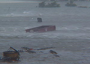
Note 2: One reader made what I thought was an execellent suggestion, so I am putting it out there for you readers: If you have any storm stories or tidbits you would like to share in an entry along the lines of “Surviving the Storm”, email them to my along with how you would like to be listed (to give you credit for the entry) and I’ll put up a special section in the next few days or week. Or if you have one or two good pictures such as the following, send it to me.

Invest 98L

The NHC is watching Invest 98L, which is located about 600 miles west/southwest of the Cape Verde islands has formed. As a wave it did not garner much attention from the NHC or other organizations.

As with any invest, the model runs are all over the place, however the SHIPS model does bring this system to a Tropical Storm with 70kt winds. The invest is fighting shear and dry air to the north, as virtually all of the systems have this season.

It is much too early to even guess what will happen with this system, but suffice to say, the season’s activity is increasing.

As more data becomes available, I’ll provide more information.

Inland Ernesto

Ernesto is now well inland. He has proven to be all but impossible to track as the models had him everywhere from Mexico to the “Big Bend” of Florida befire he struck Cuba, and subsequently, Southern Florida this evening.

Part of the fault lies in that a tropical storm can and does change centers of rotation which is what we use to determine not only the path, but the possible intensity.

After the calamities of Katrina, Rita, and Ivan, perhaps all of us are jumping a bit fast trying to predict the unpredictable.

Taking a deep breath, and a sigh of relief, many are fortunate tonight. The tropical conditions, upon initial reports, from Haiti and Cuba are nowhere near as bad as they could have been and have been in the past. Miami and the general southern Florida areas have experienced worse thunderstorms than the conditions they are facing now. Flooding, especially in the form of flash floods remain a very real and lethal threat from Ernesto, but catastrophic damage is not in the forecast.

Ernesto will emerge into the Atlantic, assuming he survives his visit to Florida, and could preset hurricane conditions to the Carolinas. At this point, I feel that we should wait and see.

-=-=-=-=-=-=-=-

Elsewhere we have a pair of waves in the Central Atlantic that could become something. One of the 300+ GFDL model runs again puts a little prize in the Gulf of Mexico within the next couple of weeks, but as we are seeing this season, the long term model runs are not verifying.

Of note, the Pacific Storm Ioke has a classic satellite formation and is one of the strongest storms I have seen. At one point sustained winds were 160mph, with gust up to 196mph. Wow. Super Typhoon Ioke appears to pose no threat to land.

I, like many others, feel great relief that Ernesto is about as minimal as he can be given the potential that lay before that storm. However, I urge you not to be lulled, as the SST’s in the GoM remain high, conditions for cyclonic activity are improving. We are in the middle of our hurricane season and still have a long way to go.