![]()
Once Omar passes through the islands, including my personal favorite of St. Maartin, the threat to land should all but vanish. Omar continues to strengthen, and should reach Catagory Two status by tomorrow morning.

Tropical information for the Coast, by the Coast,
![]()
Tropical Storm Omar developed over the past several days from a low pressure area in the eastern Caribbean south of Jamaica, Haiti and Puerto Rico. This storm is being steered by upper level currents that will place it in a northeasterly direction by October 8-10. There is a good chance that this storm will make Hurricane status but it will be an Atlantic Ocean storm and will not affect any significant land mass for at least 7 to 10 days. It will be moving toward Europe in approximately 10 days.
Unless this storm has an unforeseen direction change, this will be our only Named Storm Omar posting.
Please use the first link below for Tropical System information and the second link below for active watches, warnings and data.
http://www.weather.gov/largemap.php
==================================================
“THIS IS NOT AN OFFICIAL ADVISORY. These updates and advisories are based upon information from our own computer models, NOAA, Local Weather Data Centers, deep water Buoy Data, and other publicly available sources. FOR THE SAFETY OF YOUR PROPERTY AND PERSON, please refer to your Local, State, and Federal Authority updates for Official Advisories and Orders. For up to the minute advisories and official updates, it is essential that you monitor your local Emergency Government, NOAA and Local Media Broadcasts. Please do not make personal safety decisions based upon information presented here in this Unofficial Advisory.”
==================================================
Tropical Storm Marco intensified from a low pressure area in the southern Gulf of Mexico. It is a very compact storm but may intensify to Catagory 1 Hurricane strength before landfall in eastern coastal Mexico on Tuesday. Due to the close proximity of this storm to the coast of Mexico and imminent landfall within 12 to 24 hours, this will be our only posting for this storm. It will have no involvement on US Coastal Areas and limited involvement on the coast of Mexico due to it’s small size.
Please use the first link below for Tropical System information and the second link below for active watches, warnings and data.
http://www.nhc.noaa.gov/
http://www.weather.gov/largemap.php
================================================== =======
“THIS IS NOT AN OFFICIAL ADVISORY. These updates and advisories are based upon information from our own computer models, NOAA, Local Weather Data Centers, deep water Buoy Data, and other publicly available sources. FOR THE SAFETY OF YOUR PROPERTY AND PERSON, please refer to your Local, State, and Federal Authority updates for Official Advisories and Orders. For up to the minute advisories and official updates, it is essential that you monitor your local Emergency Government, NOAA and Local Media Broadcasts. Please do not make personal safety decisions based upon information presented here in this Unofficial Advisory.”
================================================== =======
Kyle is edging closer to hurricane strength with sustained winds of 70 mph. For the first time in 17 years, Maine is under a Hurricane Watch.
This special weather statement is being provided by our analysis group as supplied by the National Hurricane Center in Miami, Florida, Thursday morning, September 25, 2008. Any persons with interests along the East Coast of the US please note:
A WELL-DEFINED SURFACE LOW PRESSURE SYSTEM CENTERED ABOUT 225 MILES SOUTHEAST OF THE SOUTH CAROLINA-NORTH CAROLINA BORDER IS MOVING SLOWLY WESTWARD. SHOWERS AND THUNDERSTORMS HAVE BECOME A LITTLE BETTER ORGANIZED THIS MORNING AND THIS SYSTEM COULD DEVELOP INTO A SUBTROPICAL OR TROPICAL CYCLONE LATER TODAY. REGARDLESS OF WHETHER OR NOT THIS SYSTEM BECOMES A SUBTROPICAL OR TROPICAL CYCLONE… STRONG WINDS…COASTAL FLOODING…HIGH SURF…AND DANGEROUS RIP CURRENTS WILL CONTINUE ALONG PORTIONS OF THE U.S. EAST COAST DURING THE NEXT COUPLE OF DAYS. OUTER RAINBANDS ARE ALREADY SPREADING ONSHORE THE SOUTHEASTERN COAST OF NORTH CAROLINA…AND BUOY AND SHIP REPORTS INDICATE WINDS IN EXCESS OF 50 MPH ARE OCCURRING NORTH AND WEST OF THE CENTER. INTERESTS ALONG THE U.S. EAST COAST FROM
THE CAROLINAS NORTHWARD TO MID-ATLANTIC REGION SHOULD CLOSELY MONITOR STATEMENTS FROM THEIR LOCAL NATIONAL WEATHER SERVICE FORECAST OFFICES…AND ALSO HIGH SEAS FORECASTS ISSUED BY THE OCEAN PREDICTION CENTER IN WASHINGTON D.C. FOR ADDITIONAL INFORMATION AND WARNINGS.
We would only add that this system could rapidly develop into a Tropical or Subtropical storm at any time. It is drawing energy from the warm Gulf Stream waters and is gathering core strength. We are also watching another low pressure area near Hispaniola that also has high potential for development with East Coast USA involvement in several days.
Please use the first link below for Tropical System information and the second link below for active watches, warnings and data.
http://www.nhc.noaa.gov/
http://www.weather.gov/largemap.php
================================================== =======
“THIS IS NOT AN OFFICIAL ADVISORY. These updates and advisories are based upon information from our own computer models, NOAA, Local Weather Data Centers, deep water Buoy Data, and other publicly available sources. FOR THE SAFETY OF YOUR PROPERTY AND PERSON, please refer to your Local, State, and Federal Authority updates for Official Advisories and Orders. For up to the minute advisories and official updates, it is essential that you monitor your local Emergency Government, NOAA and Local Media Broadcasts. Please do not make personal safety decisions based upon information presented here in this Unofficial Advisory.”
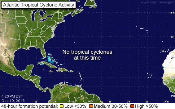
There is no tropical activity to speak of for now, although September tends to be the most active part of the season. According to Dr. Jeff Masters, we should have yet another named storm within the next 7 to 10 days, and that storm or storms could pose a threat to the East Coast and/or Gulf of Mexico after that.
Over the next month or two, the tropics should start winding down, which will bring much needed relief to stricken areas.

Hurricane Ike is making landfall near Galveston, Texas as a very strong catagory two Hurricane. 2.9 people are without power or reliable communications according to major news outlets.
There have been several rescues of people stranded, but there will be more time before the full impact of Ike is recognized. Some 24,000 people elected to remain on Galveston Island and our hopes and prayers go out to them as it will be 36 hours or more, before damage data can be processed.
Houston and areas well inland can expect hurricane force winds, tornadic activity, and torrential downpours.
As the eye of the storm passes over the Galveston area, the storm surge will continue to rise for a number of hours. Certain media personalities have attempted to make a mockery of this storm, and we are not impressed. Ike remains a credible threat for a number of hours along the western gulf coast, and especially Texas.
As data filters in, we will publish final damage reports from Hurricane Ike over the next few days.