Important Severe Storm Information for April 25 to April 30, 2014

There is a significant severe inland weather situation developing for the Southern Plains States, the Deep South and Southeast over the next few days. Weather analysis is showing a potential for severe storms, high winds, hail and some long track tornadoes extending from northeastern Texas, Oklahoma and Kansas from late Friday into Sunday. These storms will move easterly over the weekend and will also be affecting Louisiana, Arkansas, Missouri, southern Illinois, Kentucky, Tennessee, Alabama, Mississippi, northwestern Florida and Georgia through Tuesay,  April 29.  The storms will then continue to track into southeastern and east central Atlantic coastal areas on Wednesday and Thursday.  Persons in these areas should monitor your local media and National Weather Service broadcasts for alerts, watches and warnings. You may also use the interactive link to the NWS weather alert system by clicking on the link located in the BLOG area, top right navigation bar on this page.

While our TSRC office normally does not post inland storm details, this situation is an exception since a significant tornado threat is developing over such a wide area.


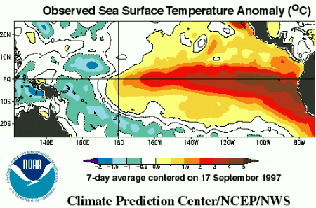
2014 May see El Nino Effect

Warmer than normal Pacific Ocean

The NWS and NOAA are predicting a greater than 50% chance of an El Nino effect, which means warmer water temperatures in the Pacific Ocean and cooler than normal water temperatures in the Atlantic Ocean.  During El Nino, we typically have fewer tropical systems in the Atlantic and in the Gulf of Mexico.  In 1992, there was an El Nino event, and only 7 storms formed, however, one of those seven was Hurricane Andrew.

Off Season Interactive Link

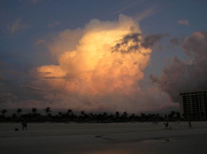
Marco Island Florida storm 40 minutes after sunset

Welcome to gulfstorm.net, the interactive website of the
Tropical Storm Research Center  with regional offices in Gulf Shores, Alabama, and Green Bay, Wisconsin.

Our primary responsibility is to provide information during the Tropical Storm season each June through November. However, we are providing a link below to the National Weather Service interactive weather map in the event that you have concerns about inland weather in your area. Click on the link below OR copy and paste the link into your browser. Then click on your area on the map for interactive information.

http://www.nws.noaa.gov/largemap.php

You can also click on the BLOG button in the navigation bar at the top right of this page for regional and local details.