Quiet after some activity
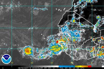
The tropics are fairly quiet after a couple of interesting weeks. None of the developments over the past month have posed a direct threat to the Gulf Shores/Orange Beach area. Currently, as evidenced below, there is one Invest (area of interest) moving off the coast of Africa.
The tropical wave is disorganized, but does show some potential for development, albeit, assuming it does develop, it would probably become a “fish”. (This means that it should meander harmlessly around the Atlantic much like Hurricane Bertha and T.S. Cristobal
If the month of July is any indication, then as we enter the “meat” of the 2008 hurricane season, we should be looking at increased activity through August and September.
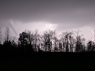
More to our immediate concern is the possibility of localized severe storms and flash flooding over the next few days. The primary threat of severe weather should be well to the north of us.
Severe Weather and Upgraded Hurricane ‘cast
Sub-Tropical Storm Olga
Tropical Storm Karen
Tropical Storm Karen has formed in the central Atlantic. While most models have the system intensifying to hurricane strength, at this point Karen does not appear to be a threat to any land masses. There is a chance that Karen could miss the trough that is expected to make her recurve north, and if that unlikely event occurs, Karen could pose a threat to the U.S. East Coast.
However, Karen seems perfectly content posing a threat to only the rogue flying fish or two.
The shear has lessened in the Gulf of Mexico, and we should see a tropical depression or tropical storm form from the area of disturbed weather in the western GoM, and that system is expected to push into Mexico.
Invest 97L continues to churn towards the Lesser Antilles, and should be monitored as conditions are ripe for development.
Atlantic on Fire – 4 Active Systems
There are three active systems in the Atlantic Basin, and the fourth in the Gulf of Mexico.
TD Jerry – Jerry is chugging along happily, and is now weakening and should dissapate soon in the north central atlantic ocean.
Invest 94L – Invest 94L is in the western GoM, and is expected to become a rainmaker for Mexico, and possibly south Texas. There is some concern that this storm could stall, then move erractically through the Gulf.
Invest 97L – This one is also showing signs of life, and is moving towards the Lesser Antilles. The threat area for Gulf Shores/Orange Beach remains slight, but this far out, the system certainly warrants attention from all U.S. interests.
Invest 96L – One word. Monster. This is a massive system in terms of size. While it too is showing signs of intensification, the size of this beast could easily help to slow its progress. On the downside, aside from some pockets of shear, this system has plenty of time and open water to overcome just about any shortfall it may have at the time of this writing.
Invest 93L – To be TD 10?
Tropical Storm Ingrid
Nearly all of the models have Ingrid swimming to sea to play with all the fishies, assuming she survives the high shear she is likely to encounter over the next few days.
Right now, there is no real threat posed to the United States, but if she adopts a more westwardly track, then Florida and the East Coast could be under the gun. My personal opinion is that Ingrid has a 50/50 chance at survival.
Surprise Hurricane Humberto is dumping much needed rain across the South East, currently affecting Mississippi and Alabama. Some models have him re-emerging into the Gulf and forming up again, but his remnants are taking a beating in the central southeast.
Tropical Storm Humberto
Tropical Storm Humberto (omm-BAIR-toe) has formed about 45 miles from Galveston, TX. Area of impact will be Texas and portions of Louisiana.
Humberto continues to strengthen, and while it is not likely he will reach Catagory One Hurricane status, it certainly is a possibility. The storm is drifting and appears that landfall will not be until early morning.
Flooding remains the biggest threat to rain deluged Texas.
Elsewhere, Tropic Depression #8 continues to move WNW and could face East Florida as a tropical storm/hurricane next week.


