Tropical Storm Karen

Tropical Storm Karen has formed in the central Atlantic. While most models have the system intensifying to hurricane strength, at this point Karen does not appear to be a threat to any land masses. There is a chance that Karen could miss the trough that is expected to make her recurve north, and if that unlikely event occurs, Karen could pose a threat to the U.S. East Coast.

However, Karen seems perfectly content posing a threat to only the rogue flying fish or two.

The shear has lessened in the Gulf of Mexico, and we should see a tropical depression or tropical storm form from the area of disturbed weather in the western GoM, and that system is expected to push into Mexico.

Invest 97L continues to churn towards the Lesser Antilles, and should be monitored as conditions are ripe for development.

Atlantic on Fire – 4 Active Systems

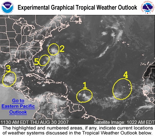
There are three active systems in the Atlantic Basin, and the fourth in the Gulf of Mexico.

TD Jerry – Jerry is chugging along happily, and is now weakening and should dissapate soon in the north central atlantic ocean.

Invest 94L – Invest 94L is in the western GoM, and is expected to become a rainmaker for Mexico, and possibly south Texas. There is some concern that this storm could stall, then move erractically through the Gulf.

Invest 97L – This one is also showing signs of life, and is moving towards the Lesser Antilles. The threat area for Gulf Shores/Orange Beach remains slight, but this far out, the system certainly warrants attention from all U.S. interests.

Invest 96L – One word. Monster. This is a massive system in terms of size. While it too is showing signs of intensification, the size of this beast could easily help to slow its progress. On the downside, aside from some pockets of shear, this system has plenty of time and open water to overcome just about any shortfall it may have at the time of this writing.

Invest 93L – To be TD 10?

Invest 93L was showing two areas of rotation, with the northern center appearing to take over and start wrapping. It should become TD 10 later today and Tropical Storm Jerry by landfall at somepoint tomorrow. The system is not looking very healthy, but conditions have improved for some strengthening.

The models have the storm making landfall in Mississippi and they look to verify. The system should come in as a weak tropical storm, and the main concern will be flooding and localized severe weather.

Tropical Storm Ingrid

Nearly all of the models have Ingrid swimming to sea to play with all the fishies, assuming she survives the high shear she is likely to encounter over the next few days.

Right now, there is no real threat posed to the United States, but if she adopts a more westwardly track, then Florida and the East Coast could be under the gun. My personal opinion is that Ingrid has a 50/50 chance at survival.

Surprise Hurricane Humberto is dumping much needed rain across the South East, currently affecting Mississippi and Alabama. Some models have him re-emerging into the Gulf and forming up again, but his remnants are taking a beating in the central southeast.

Tropical Storm Humberto

Tropical Storm Humberto (omm-BAIR-toe) has formed about 45 miles from Galveston, TX. Area of impact will be Texas and portions of Louisiana.

Humberto continues to strengthen, and while it is not likely he will reach Catagory One Hurricane status, it certainly is a possibility. The storm is drifting and appears that landfall will not be until early morning.

Flooding remains the biggest threat to rain deluged Texas.

Elsewhere, Tropic Depression #8 continues to move WNW and could face East Florida as a tropical storm/hurricane next week.

Felix – Catagory FIVE Hurricane

Felix has shown us a prime example of a rapid intensification cycle and is now a Major Catagory Five Hurricane with sustained winds at 165 mph and gusts over 200 mph.

Fortunately, the windfield currently only extends about 25 miles from the center, making this a compact and powerful storm.

Tracking brings this storm into an area around Belize City and impact in Honduras. While a re-curve remains an outside possibility, this storm appears dead set on being a Central American threat. Depending on total size and landfall, this storm has the potential to kill more than Katrina.

Tropical Storm Felix

Tropical Storm Felix is expected to become a hurricane over the next several hours, and is dead set on following in Dean’s footsteps. Mexico will be under the gun again, and at this point there does not appear to be a threat to the United States.

Elsewhere, the Atlantic remains active with several areas that have the potential to “spin up”. The next week could become interesting as the tropical systems continue to churn up the Atlantic.

Invests a plenty in the Atlantic

Currently, there are four areas of investigation in the Atlantic and Gulf of Mexico. You can see them in the graphic above. Nearly all of them are facing the potential for development, however the one in the Gulf of Mexico in the Bay of Campeche will probably interact with land before it can get anything going.

Invest 94L – Eastern Atlantic

Invest 94L is chugging along in the Eastern Atlantic today, and while it has been looking a bit raggedy of late, it is starting to show signs of convection. Most of the major models do not show this system reaching Tropical Storm status, however, several meteorologists think there is a 30% chance of development (meaning 70% that it will not “spin up”)

If it did, it would follow a track slightly to the north of Dean, and based on the ridging, would likely be a FL/GoM system.

Elsewhere, the Atlantic Basin does not have and real “hot spots”.

Tropics are Settling Down

With the exception of the 2nd blow from Hurricane Dean into Mexico, the tropics are fairly quiet. Invest 92L has fizzled for the time being, and the wave off of the coast of Africa has several hurdles to overcome before getting that tropical “ummph”.

There is an area near the Bahamas that would have an outside chance of threatening Florida, but if it was to develop, it would need to do so “rikity tik”. It does not have time to do much more than make some rain before impacting Florida.

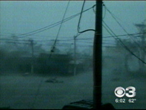
Damage and casualty reports are still coming in from Dean, but with his speed and landfall in a relatively unpopulated area, it is looking like it is nowhere near as bad as it could have been. At the time of this writing, no fatalities have been reported. Cancun and Cozmel appeared to have fared very well in this system. The following are a couple of shots as Dean moved in:

Former Major Hurricane Dean is about to be gone. He will crash into Mexico once again. Belize should be okay, they will experience Tropical Storm conditions, and heavy rain. Surge should not be a problem, but flooding and mudslides could become an issue.

Dean has the potential to intensify before the second landfall in Mexico, and could emerge in the Pacific as a tropical system. From a scientific aspect, it would be interesting to see an African storm traverse two oceans.

However, that is pretty much impossible as while the Bay of Campeche will allow some growth of the storm, it is almost out of running room (roughly 375 miles).

El gobierno de Mejico descontinuo el aviso de huracan desde Progresso hasta Campeche.Se mantiene el aviso de huracan desde la costa del golfo de Mejico desde el sur de Campeche hacia el oeste hasta Tampico.El gobierno de Mejico extiende el aviso de tormenta tropical hacia el norte de Tampico hasta bahia de algodones.

In no way am I making light of this system, but for recreation, the surfers should be finding good swells in south Texas. 13 foot waves.