TAKE ACTION NOW!
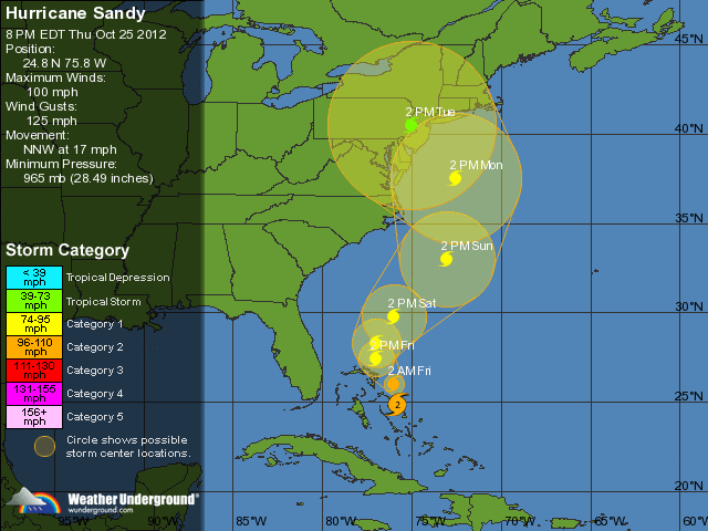
Based on current data, while Sandy is looking a bit rough around the edges after traversing the Caribbean, however, this storm is steadily moving north. Tracking along side the Eastern Seaboard of the U.S., Sandy is bringing the potential for a massive weather event. Our models suggest that Sandy will make landfall in/near New England.
Of note, portions of the areas affected should expect to be without power with night-time temperatures below 30 degrees. Additionally, there is a low pressure system moving out of Canada that may interact with this system. What this means, in short, could be something similar to the storm from 1991. Caution and preparations should be rushed to completion in areas from North Carolina to Maine.
Several media outlets are already dubbing this weather system as a $1B storm, and if current model trajectories hold, I (personally) feel that said damages could well exceed that number.

