Named Storm Ophelia – Initial Advisory Sept. 21

Tropical Storm Ophelia is located in the central Atlantic about 2000 miles east of the Leeward Islands. The storm will be encountering upper level wind shear and some dry air masses which will prevent it from strengthening much for the next 3 to 5 days. This storm is moving west at 12 to 14 MPH and is taking a southern track thus far. This storm will affect the Leeward and Windward Islands and Puerto Rico late this weekend into early next week. While it is much to early to give a precise track that may affect the southeastern US, we are asking that persons in Florida start monitoring this storm’s progress. We will post additional information as needed in a few days when this storm’s progress and potential track has been analyzed more.

For up to the minute official advisories and information, please visit the NHC website in Miami:

http://www.nhc.noaa.gov/

We are also providing an interactive Watch and Warning web link for persons who wish to get details on localized conditions:

http://www.nws.noaa.gov/largemap.php

=============================================

“THIS IS NOT AN OFFICIAL ADVISORY. These updates and advisories are based upon information from our own computer models, NOAA, Local Weather Data Centers, deep water Buoy Data, and other publicly available sources. FOR THE SAFETY OF YOUR PROPERTY AND PERSON, please refer to your Local, State, and Federal Authority updates for Official Advisories and Orders. For up to the minute advisories and official updates, it is essential that you monitor your local Emergency Government, NOAA and Local Media Broadcasts. Please do not make personal safety decisions based upon information presented here in this Unofficial Advisory.”

http://www.wootaah.blogspot.com

============================================

Tropical Storm Maria – Final Update

Tropical Storm Maria Update and final post, 4 AM EDT September 13, 2011. As anticipated, high pressure with an associated dry air mass is steering the storm more northward away from the coastal US – following a similar track to Hurricane Katia. US east coastal regions may see increased surf and the resulting rip currents as well as some rain showers occasionally for the next week or so. However, the effects will be minimal. This will be our final Tropical Storm Maria posting.

For up to the minute official advisories and information, please visit the NHC website in Miami:

http://www.nhc.noaa.gov/

We are also providing an interactive Watch and Warning web link for persons who wish to get details on localized conditions:

http://www.nws.noaa.gov/largemap.php

=============================================

“THIS IS NOT AN OFFICIAL ADVISORY. These updates and advisories are based upon information from our own computer models, NOAA, Local Weather Data Centers, deep water Buoy Data, and other publicly available sources. FOR THE SAFETY OF YOUR PROPERTY AND PERSON, please refer to your Local, State, and Federal Authority updates for Official Advisories and Orders. For up to the minute advisories and official updates, it is essential that you monitor your local Emergency Government, NOAA and Local Media Broadcasts. Please do not make personal safety decisions based upon information presented here in this Unofficial Advisory.”

http://www.wootaah.blogspot.com

Weather Information Copyrighted TSRC 2011, All Rights Reserved.

============================================

Named Storms Maria and Nate

Named Storms Maria and Nate formed from tropical low pressure areas late Wednesday, September 7. Tropical Storm Maria is currently in the east central Atlantic moving north-northwest. Because Maria will be affected by upper level shear and dry air masses, this storm may not reach hurricane levels for several days. Maria tracking models are showing a northerly curve starting around Tuesday, September 13 and it will most likely follow a similar route that Hurricane Katia is currently taking off shore along the US east Coast. Katia is causing high surf and dangerous rip currents along the east coast. Maria will most likely cause the same effects starting around Tuesday, September 13.

Tropical Storm Nate is in the south central Gulf of Mexico. The tracking models are showing northwesterly movement and hurricane status by sometime Friday, September 9. Probabilities are that Named Storm Nate will be making a northeast Mexico landfall late Monday or early Tuesday, however one tracking model is showing a track much farther to the north and we are watching this possibility closely.

For up to the minute official advisories and information, please visit the NHC website in Miami:

http://www.nhc.noaa.gov/

We are also providing an interactive Watch and Warning web link for persons who wish to get details on localized conditions:

http://www.nws.noaa.gov/largemap.php

=============================================

“THIS IS NOT AN OFFICIAL ADVISORY. These updates and advisories are based upon information from our own computer models, NOAA, Local Weather Data Centers, deep water Buoy Data, and other publicly available sources. FOR THE SAFETY OF YOUR PROPERTY AND PERSON, please refer to your Local, State, and Federal Authority updates for Official Advisories and Orders. For up to the minute advisories and official updates, it is essential that you monitor your local Emergency Government, NOAA and Local Media Broadcasts. Please do not make personal safety decisions based upon information presented here in this Unofficial Advisory.”

http://www.wootaah.blogspot.com

============================================
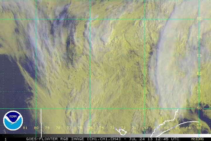
Hurricane Katia Update September 07, 2011

Hurricane Katia Update September 07, 2011. As the result of the storm slowing it’s forward movement to less than 10 miles per hour to the northwest, two weather systems are now steering Katia slightly away from the US mainland. However, since the Tropical Storm level wind field surrounding this hurricane is so broad, parts of the US coast from Georgia to New England will see an increase in surf heights and higher than normal tides along with dangerous rip currents and some localized rain over the next several days.

We are carefully watching Tropical Depression # 14 – This one is tracking much farther to the south than Katia and may become a southeastern US issue by the middle of next week. There is also a disturbance in the southern Gulf of Mexico that may be an issue for Gulf Coast States in just a few days. When either of these low pressure areas becomes a ‘named storm’, we will start new postings accordingly.

For up to the minute official advisories and information, please visit the NHC website in Miami:

http://www.nhc.noaa.gov/

=============================================

“THIS IS NOT AN OFFICIAL ADVISORY. These updates and advisories are based upon information from our own computer models, NOAA, Local Weather Data Centers, deep water Buoy Data, and other publicly available sources. FOR THE SAFETY OF YOUR PROPERTY AND PERSON, please refer to your Local, State, and Federal Authority updates for Official Advisories and Orders. For up to the minute advisories and official updates, it is essential that you monitor your local Emergency Government, NOAA and Local Media Broadcasts. Please do not make personal safety decisions based upon information presented here in this Unofficial Advisory.”

http://www.wootaah.blogspot.com

============================================

Tropical Storm / Hurricane Katia Update and Info

Tropical Storm / Hurricane Katia has shown a trend in our own tracking models to move further to the west than some other reports are showing. We are renewing our call for persons in Florida, Georgia, South Carolina, North Carolina and the Gulf Coast States to monitor this storm’s progress very carefully.

We are also just mentioning that Tropical Depression # 13, which will probably become a Tropical Storm later today in the central Gulf of Mexico, will produce huge amounts of rain and gusty winds from the Florida Panhandle to the Louisiana/Texas border. Residents in the southern regions of Louisiana, Mississippi, Alabama and northwestern Florida will experience some lowlands flooding, high coastal surf, dangerous rip currents and very strong thunderstorms over the next several days. We will not post any additional data regarding this Gulf storm because of it’s close proximity to land already.

We are also watching a low pressure area off the coast of Nova Scotia for possible strengthening. However, this low pressure area is moving out to sea and will not affect the US.

For up to the minute official advisories and information, please visit the NHC website in Miami:

http://www.nhc.noaa.gov/

=============================================

“THIS IS NOT AN OFFICIAL ADVISORY. These updates and advisories are based upon information from our own computer models, NOAA, Local Weather Data Centers, deep water Buoy Data, and other publicly available sources. FOR THE SAFETY OF YOUR PROPERTY AND PERSON, please refer to your Local, State, and Federal Authority updates for Official Advisories and Orders. For up to the minute advisories and official updates, it is essential that you monitor your local Emergency Government, NOAA and Local Media Broadcasts. Please do not make personal safety decisions based upon information presented here in this Unofficial Advisory.”

http://www.wootaah.blogspot.com

============================================

Tropical Storm (soon to be) Hurricane Katia

Tropical Storm Katia formed in the mid Atlantic early August 30 from Tropical Depression # 12. This storm is gaining strength rapidly and tracking models are showing this as a Major (Category 3 or higher) Hurricane by late Saturday or early Sunday. While projections at this time are imprecise, we have a concern that one of the tracking models is showing a south Florida involvement in just over a week. Timing is critical as to the upper level flow meeting the storm and influencing it’s direction. We will post new information as necessary. However, we are asking that all persons in Florida, Georgia, South and North Carolina and the Gulf Coast States start monitoring the progress of this storm and listen carefully to your local official advisories.

For up to the minute official advisories and information, please visit the NHC website in Miami:

http://www.nhc.noaa.gov/

=============================================

“THIS IS NOT AN OFFICIAL ADVISORY. These updates and advisories are based upon information from our own computer models, NOAA, Local Weather Data Centers, deep water Buoy Data, and other publicly available sources. FOR THE SAFETY OF YOUR PROPERTY AND PERSON, please refer to your Local, State, and Federal Authority updates for Official Advisories and Orders. For up to the minute advisories and official updates, it is essential that you monitor your local Emergency Government, NOAA and Local Media Broadcasts. Please do not make personal safety decisions based upon information presented here in this Unofficial Advisory.”

http://www.wootaah.blogspot.com

============================================

Named Storm Irene Information Sunday, August 28, 12:35 Hrs EDT.

Named Storm Irene Information Sunday, August 28, 12:35 Hrs EDT.

The storm has delivered a record setting blow to the states along the East Coast of the US. Death tolls and damage estimates will be announced by each Governor as inspection teams and medical personnel report in over the next week or so. Many persons well be in shelters for many days yet and power will not be restored to some areas for up to two weeks. Persons using GENERATORS – DO NOT place the generator inside your home or garage. The CARBON MONOXIDE from the exhaust can kill you. Place the generator no closer than 10 feet from your residence and follow ALL the safety statements in the owner’s manual regarding usage and refueling. If you are worried about it being stolen, take turns guarding it, but follow ALL applicable laws in your area regarding self protection and the protection of property.

For persons from North Carolina northward to eastern Canada… RIVERS will not flood crest in some ares for a couple days, yet. Flooding in low lying areas will continue for over a week, even though the storm itself is leaving the New England area at nearly 30 MPH to the north-northeast.

If you encounter a flooded roadway – take the advice of the American Red Cross and other agencies…

Turn Around – Don’t Drown.”

This will be our final Named Storm Irene posting. We will not be posting information about Named Storm Jose because it poses no threat to US coastal areas at this time.

Take Care and Be Safe!!!

For up to the minute official advisories and information, please visit the NHC website in Miami:

http://www.nhc.noaa.gov/

=============================================

“THIS IS NOT AN OFFICIAL ADVISORY. These updates and advisories are based upon information from our own computer models, NOAA, Local Weather Data Centers, deep water Buoy Data, and other publicly available sources. FOR THE SAFETY OF YOUR PROPERTY AND PERSON, please refer to your Local, State, and Federal Authority updates for Official Advisories and Orders. For up to the minute advisories and official updates, it is essential that you monitor your local Emergency Government, NOAA and Local Media Broadcasts. Please do not make personal safety decisions based upon information presented here in this Unofficial Advisory.”

http://www.wootaah.blogspot.com

============================================

Hurricane Irene

Irene continues some intensification, however, the ERC (Eyewall Replacement Cycle) took longer than anticipated, and thus, Irene missed an opportunity for a rapid intensification cycle. Irene remains a very large Category 3 storm, and its wind-field will likely be larger than the forecast cone. Storm surge coupled with high tides are affecting Florida, and injuries have been reported.

We will monitor the development of this system. Additionally, the tropics over the next weeks should be very active, and we will provide more information as TD 10 and invest 91L continue their progression across the North Atlantic.

HURRICANE IRENE Update August 25, 2011

HURRICANE IRENE Update – August 25, 2011.

We have posted tracking information and strength projections in our previous postings. Today we are again calling for all persons living in or near coastal areas from southeastern Florida all the way up the East Coast to the Canadian Maritime Provinces to BE ALERT and BE PREPARED!

Hurricane Irene is a Category 3 hurricane – a MAJOR. It is expected to INCREASE in intensity and to widen as it does.

This will involve more coastal areas as the hurricane makes it’s way up the entire East Coast of the US. This hurricane will, in some way, directly affect nearly 30 million people as well as animals and pets.

Persons near the coastal areas of South Carolina and especially North Carolina, are already under Emergency Operations Center orders for regional evacuations. Persons in coastal Virginia, Maryland, Delaware, New Jersey, New York, and most of New England will be under additional EOC orders of varying degrees from Friday into early next week. Persons in low lying coastal areas all along the East Coast will experience local flooding due to high wave action and storm surge potential as well as high winds, torrential rains, lightning, and tornadoes in the outer rain bands.

Do not be complacent and think that this hurricane will not affect you – If you are in or near coastal areas of the East Coast – IT WILL.

For up to the minute official advisories and information, please visit the NHC website in Miami:

http://www.nhc.noaa.gov/

=============================================

“THIS IS NOT AN OFFICIAL ADVISORY. These updates and advisories are based upon information from our own computer models, NOAA, Local Weather Data Centers, deep water Buoy Data, and other publicly available sources. FOR THE SAFETY OF YOUR PROPERTY AND PERSON, please refer to your Local, State, and Federal Authority updates for Official Advisories and Orders. For up to the minute advisories and official updates, it is essential that you monitor your local Emergency Government, NOAA and Local Media Broadcasts. Please do not make personal safety decisions based upon information presented here in this Unofficial Advisory.”

http://www.wootaah.blogspot.com

============================================

HURRICANE IRENE Update August 24

HURRICANE IRENE Update Wednesday August 24 – 07:00 Hrs EDT

As anticipated, Hurricane Irene has stated to track a little more to the north. The hurricane’s ultimate track is shifting slightly more offshore as it will be traveling up the entire East Coast of the United States. Persons along the coast from Southeastern Florida all the way to the New England States will be impacted by this storm in some way over the next several days. Projections are showing a significant coastal North Carolina involvement by early morning, Saturday August 27.

Persons along the Atlantic coastal areas of Florida, Georgia, South Carolina, North Carolina, Virginia, Maryland, Delaware, eastern Pennsylvania, New Jersey, New York, all of coastal New England and the Canadian Maritime Provinces should be carefully monitoring the progress of this storm. Follow the orders from your local Emergency Management Agency.


For up to the minute official advisories and information, please visit the NHC website in Miami:

http://www.nhc.noaa.gov/

=============================================

“THIS IS NOT AN OFFICIAL ADVISORY. These updates and advisories are based upon information from our own computer models, NOAA, Local Weather Data Centers, deep water Buoy Data, and other publicly available sources. FOR THE SAFETY OF YOUR PROPERTY AND PERSON, please refer to your Local, State, and Federal Authority updates for Official Advisories and Orders. For up to the minute advisories and official updates, it is essential that you monitor your local Emergency Government, NOAA and Local Media Broadcasts. Please do not make personal safety decisions based upon information presented here in this Unofficial Advisory.”

http://www.wootaah.blogspot.com

============================================