The disturbance we discussed last week is still loitering around, now dubbed Invest 92L by the NHC. A recon flight is scheduled for June 1 at 2pm. This system could become a tropical depression by Saturday.
Right now, it appears that this system will become a much needed rain maker for the drought plagued state of Florida. At this time, I see no real threat to the Gulf Shores area and doubt that this system will become “Hurricane Barry”.
Of note, Hurricane Season has not begun, yet this is the third Atlantic Invest in less than a month. All data and modelling aside, that is very indicative of things to come.
Last year was an aberration, and I expect this year to see significant activity in the Gulf of Mexico.
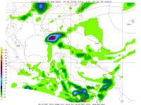
The NGM Model at 48 hours does show some impact for the Gulf Shores/Orange Beach area, but right now the risk of us experiencing tropical conditions remains marginal.

