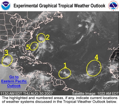
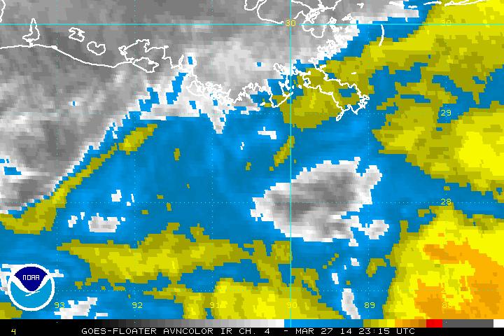
Elsewhere, the Atlantic remains active with several areas that have the potential to “spin up”. The next week could become interesting as the tropical systems continue to churn up the Atlantic.
Invests a plenty in the Atlantic
Invest 94L – Eastern Atlantic
Invest 94L is chugging along in the Eastern Atlantic today, and while it has been looking a bit raggedy of late, it is starting to show signs of convection. Most of the major models do not show this system reaching Tropical Storm status, however, several meteorologists think there is a 30% chance of development (meaning 70% that it will not “spin up”)
If it did, it would follow a track slightly to the north of Dean, and based on the ridging, would likely be a FL/GoM system.
Elsewhere, the Atlantic Basin does not have and real “hot spots”.
Tropics are Settling Down
With the exception of the 2nd blow from Hurricane Dean into Mexico, the tropics are fairly quiet. Invest 92L has fizzled for the time being, and the wave off of the coast of Africa has several hurdles to overcome before getting that tropical “ummph”.
There is an area near the Bahamas that would have an outside chance of threatening Florida, but if it was to develop, it would need to do so “rikity tik”. It does not have time to do much more than make some rain before impacting Florida.
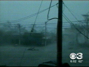
Damage and casualty reports are still coming in from Dean, but with his speed and landfall in a relatively unpopulated area, it is looking like it is nowhere near as bad as it could have been. At the time of this writing, no fatalities have been reported. Cancun and Cozmel appeared to have fared very well in this system. The following are a couple of shots as Dean moved in:

Former Major Hurricane Dean is about to be gone. He will crash into Mexico once again. Belize should be okay, they will experience Tropical Storm conditions, and heavy rain. Surge should not be a problem, but flooding and mudslides could become an issue.
Dean has the potential to intensify before the second landfall in Mexico, and could emerge in the Pacific as a tropical system. From a scientific aspect, it would be interesting to see an African storm traverse two oceans.
However, that is pretty much impossible as while the Bay of Campeche will allow some growth of the storm, it is almost out of running room (roughly 375 miles).
El gobierno de Mejico descontinuo el aviso de huracan desde Progresso hasta Campeche.Se mantiene el aviso de huracan desde la costa del golfo de Mejico desde el sur de Campeche hacia el oeste hasta Tampico.El gobierno de Mejico extiende el aviso de tormenta tropical hacia el norte de Tampico hasta bahia de algodones.
In no way am I making light of this system, but for recreation, the surfers should be finding good swells in south Texas. 13 foot waves.
Category FIVE – Dean
Severe tornado
158-206 mph
Roof and some walls torn off well constructed houses; trains overturned; most trees in forest uprooted
Dean Still Moving
Most models agree that Dean will reach Cat 5 before slamming Mexico twice. While Texas is not entirely out of the woods yet, odds are that Dean (unless he slips past the ULL and ridge) will not be a threat to the United States.
There is the possibility of a “homegrown” storm by the middle of next week, and a vigorous wave off of Africa (which remains disorganized) could play the role of “Dean..Part Deux”.
Dean has not entered the gulf yet, and if he stays south, may not enter at all. However, he is at a point to where his forecast path could be completely different from what we expect. So, in short, not an “ALL CLEAR”, but more of a “Mexico, get ready.”
Dean – Category FOUR
Dean has intensified to a Category FOUR hurricane with winds at 135mph with gusts at a whopping 184 mph! I’ll provide more information later. The NHC has shifted slightly west on the latest model run, and the GFDL has pulled back more in line, taking aim at Freeport, TX.
Dean – Category Three
Dean is now Cat 3, despite the light brush on Barbados, St. Lucie island is reporting 1 fatality, extensive roof damage and flooding. Dean appears to be in a Rapid Intensification cycle, and should attain Cat 4 status this evening or tonight.
The eyewall is in an ERC, and roughly 17 miles on the inner eye and 35 miles on the outer, meaning that this storm is growing in size much like Ivan or Katrina and less like Wilma, Rita, or Dennis.
Jamaica is on deck for a devasting hit. The low associated with Erin and the ULL over Florida are not behaving as expected, making modelling extremely difficult.
People in TX and LA should really watch this, as models are slowly trending eastward. GFDL has this approaching New Orleans.
Dean Visits Barbados
Reports from the island of Barbados indicate minimal damage and conditions have already improved. Gust near the airport were around 39 kts, with isolated reports of tropical storm and hurricane force winds during the overnight hours.
The pressure has fallen by 5 millibars in roughly 2 hours, which appears to indicate that Dean is entering a Rapid Intensification cycle. Dean is still tracking west, and if the ULL (Upper Level Low) over Florida moves west with him, then west it will be. If the ULL stays put, then Dean will curve north and east, bringing the threat to the west/north central gulf coast.
The next update and model run is scheduled for 11:30am EDT. As Dean enters the warm, deep waters of the Carribean, expect to see intensification if not explosive development.
Lastly, Dean remains a small storm with a small windfield, let’s hope that part stays the same.
